Approximate Location Map
Large Map »
Latitude: 51.2107 / 51°12'38"N
Longitude: 0.7958 / 0°47'44"E
OS Eastings: 595377
OS Northings: 149441
OS Grid: TQ953494
Mapcode National: GBR RW0.404
Mapcode Global: VHKK6.RT2Q
Plus Code: 9F326Q6W+78
Entry Name: Outhouse to West of Palace Farmhouse
Listing Date: 14 February 1967
Grade: I
Source: Historic England
Source ID: 1186008
English Heritage Legacy ID: 180772
ID on this website: 101186008
Location: Charing, Ashford, Kent, TN27
County: Kent
District: Ashford
Civil Parish: Charing
Built-Up Area: Charing
Traditional County: Kent
Lieutenancy Area (Ceremonial County): Kent
Tagged with: Outhouse
1.
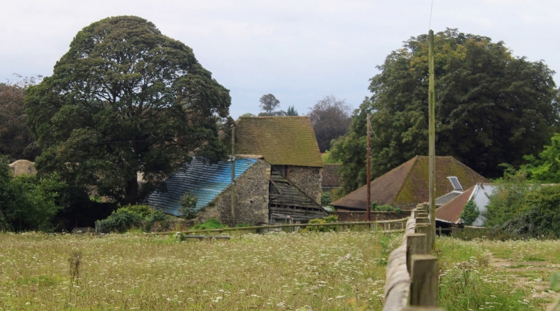
5272 CHARING MARKET PLACE
Outhouse to west of
Palace Farmhouse
TQ 9549 22/7 14.2.67
I
2.
C14. This was part of the west range of the courtyard of the former manor
house of the Archbishops of Canterbury. Flints with long and short stone quoins.
Tiled roof, hipped at the east end and with a gable end to the west. Blocked
lancet windows.
Listing NGR: TQ9537849439
External links are from the relevant listing authority and, where applicable, Wikidata. Wikidata IDs may be related buildings as well as this specific building. If you want to add or update a link, you will need to do so by editing the Wikidata entry.


Other nearby listed buildings
