Latitude: 52.0992 / 52°5'57"N
Longitude: -1.5632 / 1°33'47"W
OS Eastings: 430014
OS Northings: 244632
OS Grid: SP300446
Mapcode National: GBR 5PH.7MK
Mapcode Global: VHBYG.VHFL
Plus Code: 9C4W3CXP+MP
Entry Name: The Royal Oak Public House
Listing Date: 30 June 1986
Grade: II
Source: Historic England
Source ID: 1186080
English Heritage Legacy ID: 305934
Also known as: The Royal Oak
ID on this website: 101186080
Location: Whatcote, Stratford-on-Avon, Warwickshire, CV36
County: Warwickshire
District: Stratford-on-Avon
Civil Parish: Whatcote
Traditional County: Warwickshire
Lieutenancy Area (Ceremonial County): Warwickshire
Church of England Parish: Whatcote St Peter
Church of England Diocese: Coventry
Tagged with: Pub Restaurant
WHATCOTE SP 34 SW 3/171 The Royal Oak Public House
GV II
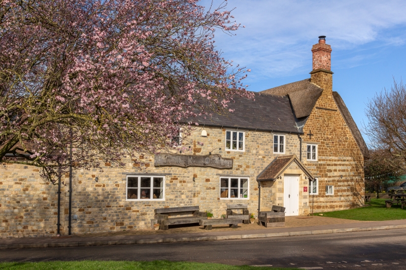
Public House. C17 with later alterations and additions. Regular coursed ironstone rubble. Steeply pitched asbestos tile roof. Slated roof to left part. Brick end stack. Single storey plus attic. L-plan. Entrance into extension to left. C20 ground floor windows. Attic has a 2-light and 3-light wood-mullioned window with wood lintel. Plank and rail door with wood lintel. Gable fronted bay to right has a 2-light wood-mullioned window and a small 2-light window with stone surround. Attic floor has a 2-light wood-mullioned window. Right end and wing attached to right have 2- and 3-light stone-mullioned windows with hood moulds and label stops and 2-light wood-mullioned windows. Interior: stop- chamfered beam in main bar. Inglenook with bressumer. Beams and joists. Stone flag floors. Plank doors. C20 extension to left end.
Listing NGR: SP3001444632
External links are from the relevant listing authority and, where applicable, Wikidata. Wikidata IDs may be related buildings as well as this specific building. If you want to add or update a link, you will need to do so by editing the Wikidata entry.


Other nearby listed buildings