Approximate Location Map
Large Map »
Latitude: 51.4643 / 51°27'51"N
Longitude: -2.593 / 2°35'34"W
OS Eastings: 358898
OS Northings: 174094
OS Grid: ST588740
Mapcode National: GBR C8F.HX
Mapcode Global: VH88N.0GJ9
Plus Code: 9C3VFC74+PQ
Entry Name: Clic House
Listing Date: 4 March 1977
Last Amended: 30 December 1994
Grade: II
Source: Historic England
Source ID: 1187204
English Heritage Legacy ID: 379586
ID on this website: 101187204
Location: Cotham, Bristol, BS6
County: City of Bristol
Electoral Ward/Division: Cotham
Parish: Non Civil Parish
Built-Up Area: Bristol
Traditional County: Gloucestershire
Lieutenancy Area (Ceremonial County): Bristol
Church of England Parish: Bristol St Matthew and St Nathanael
Church of England Diocese: Bristol
Tagged with: House
BRISTOL
ST315874 FREMANTLE SQUARE, Cotham
901-1/35/1203 (North West side)
04/03/77 Nos.11 AND 12
Clic House
(Formerly Listed as:
FREMANTLE SQUARE
Nos.7-14 (Consecutive))
GV II
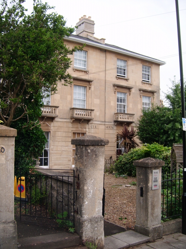
Pair of attached houses, now a single nursing home. c1850.
Probably by William Armstrong. Limestone ashlar with stucco
sides, rendered ridge stack, raised party wall and concrete
tile hip roof. Double-depth plan. Italianate style. Each of 3
storeys; 2-window range.
A symmetrical pair divided by a vertical recess at the party
wall, with a rusticated ground floor to a plat band, and
entrances in the sides. Late C20 doorways have 2-leaf panelled
doors. Recessed surrounds to deep ground-floor windows,
first-floor windows with architraves, consoles to canopies and
openwork balconies on 3 brackets, both with 6/6-pane horned
sashes; second-storey windows have corbels to cills and
3/3-pane sashes. INTERIOR: converted c1985 with new entrances
and internal openings; cornices with rose soffits, dogleg
lateral stairs with turned balusters and newels, 3-panel
shutters and panelled soffits. Shown on Ashmead's 1855 Map of
Bristol.
(Ashmead: Map of Bristol: Bristol: 1855-).
Listing NGR: ST5889874094
External links are from the relevant listing authority and, where applicable, Wikidata. Wikidata IDs may be related buildings as well as this specific building. If you want to add or update a link, you will need to do so by editing the Wikidata entry.


Other nearby listed buildings
