Approximate Location Map
Large Map »
Latitude: 52.7531 / 52°45'11"N
Longitude: -2.6025 / 2°36'8"W
OS Eastings: 359431
OS Northings: 317446
OS Grid: SJ594174
Mapcode National: GBR 7P.ZQB2
Mapcode Global: WH9CV.0207
Plus Code: 9C4VQ93X+62
Entry Name: Wall to North East of Ercall Hall
Listing Date: 18 June 1959
Grade: II
Source: Historic England
Source ID: 1187230
English Heritage Legacy ID: 362087
ID on this website: 101187230
Location: High Ercall, Telford and Wrekin, Shropshire, TF6
County: Telford and Wrekin
Civil Parish: Ercall Magna
Built-Up Area: High Ercall
Traditional County: Shropshire
Lieutenancy Area (Ceremonial County): Shropshire
Church of England Parish: High Ercall St Michael and All Angels
Church of England Diocese: Lichfield
Tagged with: Wall
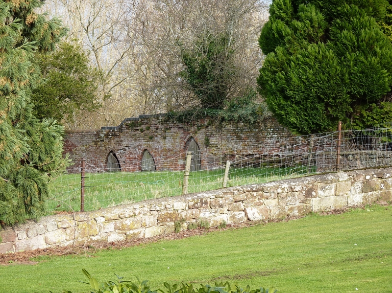
ERCALL MAGNA HIGH ERCALL
1.
5362 Wall to north-east of
Ercall Hall
SJ 5917 1/221
II GV
2.
C17 brick garden wall on sandstone foundation. Part is retaining wall to earthworks
of earlier fortifications. Three pointed-arch doorways.
Listing NGR: SJ5943217446
External links are from the relevant listing authority and, where applicable, Wikidata. Wikidata IDs may be related buildings as well as this specific building. If you want to add or update a link, you will need to do so by editing the Wikidata entry.


Other nearby listed buildings
