Latitude: 52.6929 / 52°41'34"N
Longitude: -2.2865 / 2°17'11"W
OS Eastings: 380735
OS Northings: 310622
OS Grid: SJ807106
Mapcode National: GBR 06Q.4QT
Mapcode Global: WH9D5.VKDW
Plus Code: 9C4VMPV7+5C
Entry Name: Stable Block, 60 Metres to North East of Entrance Front of Weston Hall
Listing Date: 16 May 1953
Grade: II
Source: Historic England
Source ID: 1188130
English Heritage Legacy ID: 271629
ID on this website: 101188130
Location: Weston-under-Lizard, South Staffordshire, TF11
County: Staffordshire
District: South Staffordshire
Civil Parish: Blymhill and Weston-under-Lizard
Built-Up Area: Weston-under-Lizard
Traditional County: Staffordshire
Lieutenancy Area (Ceremonial County): Staffordshire
Church of England Parish: Weston-under-Lizard St Andrew
Church of England Diocese: Lichfield
Tagged with: Stable
SJ 81 SW WESTON UNDER LIZARD C.P. WESTON PARK.
4/44 Stable Block, 60 m to 16.5.53 North East of entrance front of Weston Hall
GV II
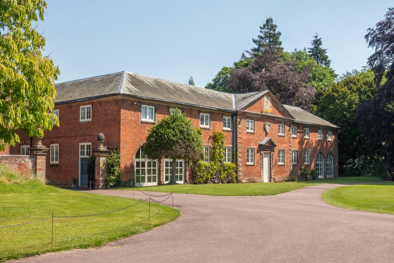
Stables, dated 1688 with later additions. Red brick, stone dressings; hipped Westmorland slate roof with coved eaves cornice. Classical style 'U' shaped plan around stableyard; 2 storey 4-2-4 front in C19 casements, pedimented centre projection, flanked by quoins; central doorway with even quoins up to shouldered surround and cornice, reduced pediment; cartouche over and sundial in main tympanum with wrought iron finial. Two blind arches to right, C19 additions to North side. Massive sandstone lintols to doors on East and West sides; dated and inscribed " T and E W 1688" on a rainwater head. Interior: Partially complete stable fittings with curved timber dividing rails.
Listing NGR: SJ8073510622
External links are from the relevant listing authority and, where applicable, Wikidata. Wikidata IDs may be related buildings as well as this specific building. If you want to add or update a link, you will need to do so by editing the Wikidata entry.


Other nearby listed buildings