Latitude: 51.2386 / 51°14'18"N
Longitude: -0.207 / 0°12'25"W
OS Eastings: 525260
OS Northings: 150351
OS Grid: TQ252503
Mapcode National: GBR JJ0.8GR
Mapcode Global: VHGS9.C4DB
Plus Code: 9C3X6QQV+C5
Entry Name: Reigate Castle Gateway
Listing Date: 19 October 1951
Grade: II
Source: Historic England
Source ID: 1188787
English Heritage Legacy ID: 289374
ID on this website: 101188787
Location: Reigate, Reigate and Banstead, Surrey, RH2
County: Surrey
District: Reigate and Banstead
Electoral Ward/Division: Reigate Central
Parish: Non Civil Parish
Built-Up Area: Reigate
Traditional County: Surrey
Lieutenancy Area (Ceremonial County): Surrey
Church of England Parish: Reigate
Church of England Diocese: Southwark
Tagged with: Gate
LONDON ROAD 1. 5388 (Castle Grounds) Reigate Reigate Castle Gateway TQ 2550 SW 12/24 19.10.51.
II
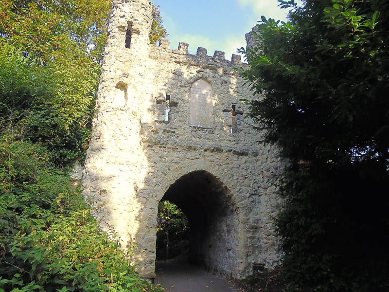
2. Purchased by Reigate Corporation in 1921. The Castle was a C12 construction of motte and bailey type with a shell keep, but none of the masonry survives. The Castle had fallen into ruins by C16 and the process was completed in 1642. But there was still something left in the C18, and out of the stones Richard Barnes built a Gothic gateway in 1777 in memory of William de Warrenne, as an inscription on this in English and Latin records. It is built of stone rubble and consists of a pointed arch with high castellated parapet over containing 2 cross-shaped windows on each front and turrets at the angles.
Listing NGR: TQ2526050351
External links are from the relevant listing authority and, where applicable, Wikidata. Wikidata IDs may be related buildings as well as this specific building. If you want to add or update a link, you will need to do so by editing the Wikidata entry.


Other nearby listed buildings