Latitude: 54.0073 / 54°0'26"N
Longitude: -1.468 / 1°28'4"W
OS Eastings: 434962
OS Northings: 456942
OS Grid: SE349569
Mapcode National: GBR LQ53.Z7
Mapcode Global: WHD9L.FJ5S
Plus Code: 9C6W2G4J+WQ
Entry Name: National School for Boys
Listing Date: 12 December 1985
Grade: II
Source: Historic England
Source ID: 1190059
English Heritage Legacy ID: 330752
ID on this website: 101190059
Location: Knaresborough, North Yorkshire, HG5
County: North Yorkshire
District: Harrogate
Civil Parish: Knaresborough
Built-Up Area: Knaresborough
Traditional County: Yorkshire
Lieutenancy Area (Ceremonial County): North Yorkshire
Church of England Parish: Knaresborough
Church of England Diocese: Leeds
Tagged with: Architectural structure
SE 3456 KNARESBOROUGH CASTLE YARD (north side)
8/88 National School for Boys
GV II
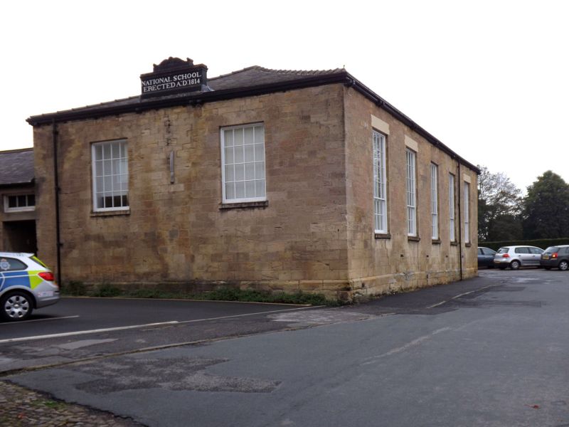
School, now offices. 1814. Ashlar, Westmorland slate roof. Single storey, 2 x 5 bays, with lower single-storey, 3-bay range to left and C20 addition to east. North front: main block has 24-pane sashes with projecting sills and shouldered wedge lintels, hipped roof, and central stone tablet above eaves level inscribed 'NATIONAL SCHOOL ERECTED 1814' with scroll decoration. Lower range: original entrance, now with C20 iron gate, on right. C20 windows. Rear: main block windows as front. Lower range has sashes with glazing bars. Interior: floor inserted to main range. This was the first school in the district to be established by the National Society for the Education of the Poor in the Principles of the Established Church which was founded in 1811. It has accommodation for 200 boys. The 1851 map shows the layout of the building, which was composed of a large hall on the west side, and about 5 small rooms along the east side. B Jennings (Ed) Harrogate and Knaresborough, 1970, pp 380-1. Ordnance Survey Map of Knaresborough, Scale 5 feet to 1 mile) 1851.
Listing NGR: SE3496256942
External links are from the relevant listing authority and, where applicable, Wikidata. Wikidata IDs may be related buildings as well as this specific building. If you want to add or update a link, you will need to do so by editing the Wikidata entry.
Other nearby listed buildings