Approximate Location Map
Large Map »
Latitude: 51.5023 / 51°30'8"N
Longitude: -0.1942 / 0°11'39"W
OS Eastings: 525434
OS Northings: 179693
OS Grid: TQ254796
Mapcode National: GBR 0H.LN
Mapcode Global: VHGQY.LH6Q
Plus Code: 9C3XGR24+W8
Entry Name: 12-54, Hornton Street W8
Listing Date: 15 April 1969
Grade: II
Source: Historic England
Source ID: 1191596
English Heritage Legacy ID: 203957
ID on this website: 101191596
Location: Kensington, Kensington and Chelsea, London, W8
County: London
District: Kensington and Chelsea
Electoral Ward/Division: Campden
Parish: Non Civil Parish
Built-Up Area: Kensington and Chelsea
Traditional County: Middlesex
Lieutenancy Area (Ceremonial County): Greater London
Church of England Parish: St Mary Abbots with Christ Church and St Philip Kensington
Church of England Diocese: London
Tagged with: Building
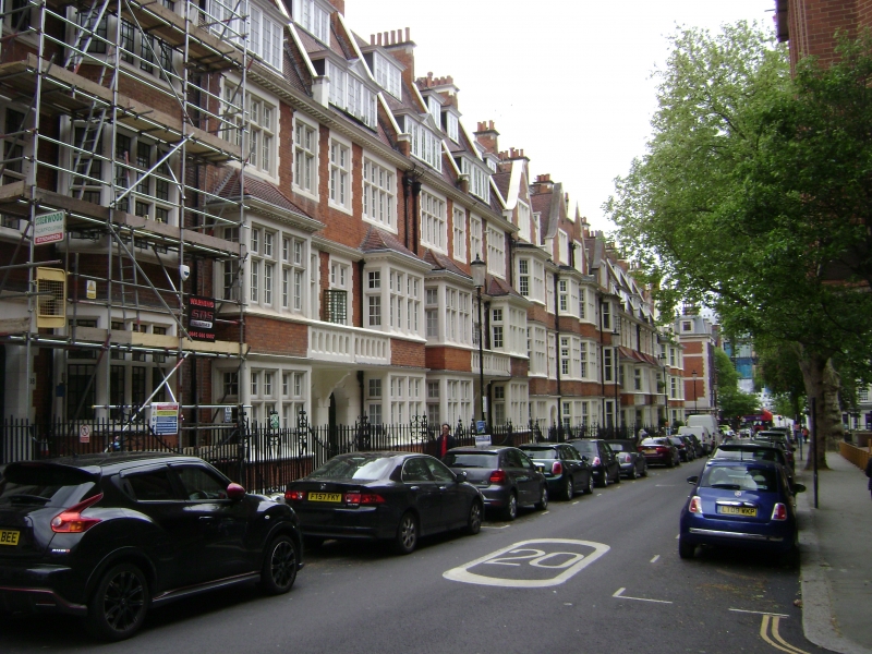
TQ 2579 NW HORNTON STREET W8
30/4
15.4.69 Nos 12 to 54 (even)
II
Terrace of houses. 1903 onwards. F S Chesterton. Three storeys + attics + basement.
Brick built with stone dressings. Pointed gables. Nos 44-54 have sash windows and
stone oriels. The rest have stone mullion windows and 2 or 3 storey bay windows.
Recessed porches with segmental headed openings. Final achievement of the Norman Shaw
movement.
Survey of London Vol 37, p 66.
Listing NGR: TQ2543479693
External links are from the relevant listing authority and, where applicable, Wikidata. Wikidata IDs may be related buildings as well as this specific building. If you want to add or update a link, you will need to do so by editing the Wikidata entry.


Other nearby listed buildings
