Latitude: 53.4986 / 53°29'54"N
Longitude: -1.4764 / 1°28'34"W
OS Eastings: 434831
OS Northings: 400334
OS Grid: SE348003
Mapcode National: GBR LW4Z.5L
Mapcode Global: WHDD3.9B68
Plus Code: 9C5WFGXF+CC
Entry Name: Stone Bar Farmhouse with Attached Stable and Barn
Listing Date: 4 December 1986
Grade: II
Source: Historic England
Source ID: 1191991
English Heritage Legacy ID: 333943
ID on this website: 101191991
Location: Tankersley, Barnsley, South Yorkshire, S70
County: Barnsley
Civil Parish: Tankersley
Built-Up Area: Birdwell
Traditional County: Yorkshire
Lieutenancy Area (Ceremonial County): South Yorkshire
Church of England Parish: Tankersley St Peter
Church of England Diocese: Sheffield
Tagged with: Farmhouse
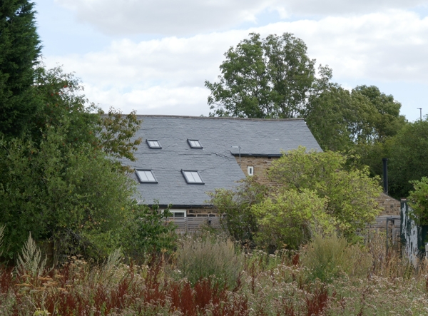
TANKERSLEY SHEFFIELD ROAD SE30SW (west side, off) Birdwell 1/67 Stone Bar Farmhouse with attached stable and barn - II Farmhouse with attached stable and barn. c1800, barn probably early C18. Coursed, rubble sandstone, stone slate roof. 2-storey, 2-bay house with stable under same roof on left and wing to rear; 2-storey barn set across left end of range. House: part-glazed door flanked by 2-light horizontal-sliding sashes, all lintels tooled as voussoirs. lst-floor windows the same. Brick end stack on right, stone ridge stack at left end of house-part. Stable: 2 stable doors with flanking casements; 9-pane casement to lst-floor left, boarded hatch on right. Barn: taller and with large quoins. Boarded harr-hung barn doors under wood lintel. Stable door and window on left, slit vent over; steeply-pitched roof. Attached farmbuildings on left of barn not of special interest.
Listing NGR: SE3483100334
External links are from the relevant listing authority and, where applicable, Wikidata. Wikidata IDs may be related buildings as well as this specific building. If you want to add or update a link, you will need to do so by editing the Wikidata entry.


Other nearby listed buildings