Latitude: 53.3771 / 53°22'37"N
Longitude: -1.1568 / 1°9'24"W
OS Eastings: 456188
OS Northings: 387023
OS Grid: SK561870
Mapcode National: GBR NYCD.B4
Mapcode Global: WHDDV.6CCX
Plus Code: 9C5W9RGV+R7
Entry Name: L-Shaped Farmbuilding at North Farm Immediately to Rear of Farmhouse
Listing Date: 15 October 1986
Grade: II
Source: Historic England
Source ID: 1192675
English Heritage Legacy ID: 335802
ID on this website: 101192675
Location: Letwell, Rotherham, South Yorkshire, S81
County: Rotherham
Civil Parish: Letwell
Traditional County: Yorkshire
Lieutenancy Area (Ceremonial County): South Yorkshire
Church of England Parish: Firbeck with Letwell
Church of England Diocese: Sheffield
Tagged with: Agricultural structure
LETWELL BARKER HADES ROAD SK58NE (north side, off) 3/54 L-shaped farmbuilding at North Farm immediately to rear of farmhouse
GV II
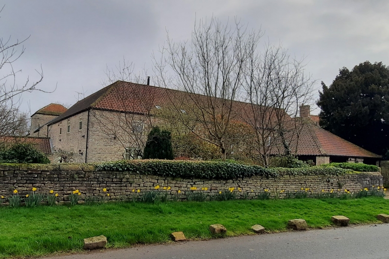
Combination farmbuilding including barn with horse-engine house. Early C19. Rubble limestone, pantile roof. L-shaped, 2-storey range with 1-storey additions. Barn, in line with wing to rear of North Farmhouse (q.v.), has basket-arched waggon entrance facing farmyard with stone ears to harr-hung boarded doors. Door on left and 3 rows of slit vents; square loft hatch. Wing projecting on right has external stone steps to 1st-floor door with arched recess beneath landing; gable hatch. Rear of barn: opposed waggon entrance with horse-engine house on its right having square and rectangular piers and hipped roof. Left return of wing has arched doorway with overlight on left; another door with rock-faced surround. on right has casement to its left; 2 casements to 1st floor. Right return: 1-storey, brick-fronted addition with 3 small pens beneath hen loft. Main element of well-preserved farmyard group.
Listing NGR: SK5618887023
External links are from the relevant listing authority and, where applicable, Wikidata. Wikidata IDs may be related buildings as well as this specific building. If you want to add or update a link, you will need to do so by editing the Wikidata entry.


Other nearby listed buildings