Latitude: 51.4288 / 51°25'43"N
Longitude: -1.8569 / 1°51'24"W
OS Eastings: 410042
OS Northings: 169984
OS Grid: SU100699
Mapcode National: GBR 3VK.CBV
Mapcode Global: VHB44.RCP1
Plus Code: 9C3WC4HV+G6
Entry Name: National Trust Shop
Listing Date: 29 April 1987
Grade: II
Source: Historic England
Source ID: 1192886
English Heritage Legacy ID: 311466
ID on this website: 101192886
Location: Avebury, Wiltshire, SN8
County: Wiltshire
Civil Parish: Avebury
Traditional County: Wiltshire
Lieutenancy Area (Ceremonial County): Wiltshire
Tagged with: Architectural structure
AVEBURY -
SU 16 NW
11/45 National Trust Shop
GV II
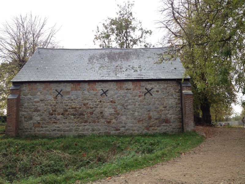
Granary, formerly with Manor Farm, now shop. C18-early C19.
Sarsen and brick, with brick dressings. Slate roof. Two storeys,
4 bays. At each end 2 segmental arched openings. Brick dressed
ventilation slots to upper floor on east, now blocked. Gable oeil.
Transverse beams with ogee chamfer stops internally and collar beam
truss with single purlins. Listed primarily for group value.
Listing NGR: SU1004269986
External links are from the relevant listing authority and, where applicable, Wikidata. Wikidata IDs may be related buildings as well as this specific building. If you want to add or update a link, you will need to do so by editing the Wikidata entry.


Other nearby listed buildings