Latitude: 53.3398 / 53°20'23"N
Longitude: -1.32 / 1°19'11"W
OS Eastings: 445376
OS Northings: 382761
OS Grid: SK453827
Mapcode National: GBR MY7T.1H
Mapcode Global: WHDDY.P9NZ
Plus Code: 9C5W8MQJ+W2
Entry Name: The Farmhouse (At Bedgreave Mill)
Listing Date: 5 December 1975
Last Amended: 15 October 1986
Grade: II
Source: Historic England
Source ID: 1193116
English Heritage Legacy ID: 335868
ID on this website: 101193116
Location: Rother Valley Country Park, Rotherham, South Yorkshire, S26
County: Rotherham
Civil Parish: Wales
Traditional County: Yorkshire
Lieutenancy Area (Ceremonial County): South Yorkshire
Church of England Parish: Wales St John the Baptist
Church of England Diocese: Sheffield
Tagged with: Farmhouse
WALES MANSFIELD ROAD SK48SE (west side, off), Wales Bar 4/117 The Farmhouse (at 5.12.75 Bedgreave Mill) (formerly listed as Bedgreave Farmhouse)
GV II
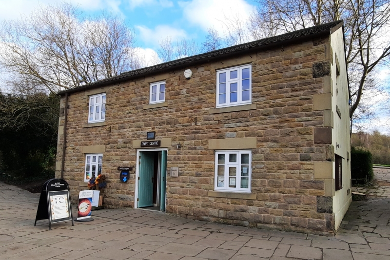
Farmhouse now offices of country park. Early C19. Coursed squared sandstone, C20 pantile roof. 2 storeys with attics, 3 windows to 1st floor. Large quoins. Central doorway with panelled door in ashlar surround with bracketed stone slab hood. Flanking 3-light casements wtih projecting sills and plain lintels; similar windows to 1st floor. Cement-rendered brick end stacks. Included for group value.
Listing NGR: SK4537682761
External links are from the relevant listing authority and, where applicable, Wikidata. Wikidata IDs may be related buildings as well as this specific building. If you want to add or update a link, you will need to do so by editing the Wikidata entry.


Other nearby listed buildings