Latitude: 51.9562 / 51°57'22"N
Longitude: -1.4229 / 1°25'22"W
OS Eastings: 439754
OS Northings: 228795
OS Grid: SP397287
Mapcode National: GBR 6SR.72W
Mapcode Global: VHBZB.9345
Plus Code: 9C3WXH4G+FR
Entry Name: The Vicarage and Attached Garden Walls
Listing Date: 27 August 1956
Last Amended: 18 May 1987
Grade: II
Source: Historic England
Source ID: 1193292
English Heritage Legacy ID: 251866
ID on this website: 101193292
Location: Great Tew, West Oxfordshire, OX7
County: Oxfordshire
District: West Oxfordshire
Civil Parish: Great Tew
Traditional County: Oxfordshire
Lieutenancy Area (Ceremonial County): Oxfordshire
Church of England Parish: Great Tew
Church of England Diocese: Oxford
Tagged with: Clergy house
GREAT TEW NEW ROAD SP3928 (West side) 12/55 The Vicarage and attached 27/08/56 garden walls. (Formerly listed as The Vicarage)
GV II
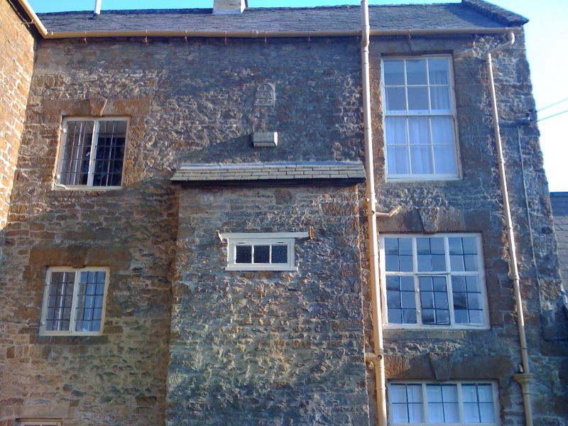
Vicarage. 1696 and 1781 on datestones, re-modelled and extended c.1830 probably by Thomas Fulljames. Marlstone ashlar and squared rubble with some limestone dressings; Welsh-slate roofs with limestone-ashlar stacks. T-plan, infilled. 2 storeys plus attic and 3 storeys. 4-window ashlar front, with chamfered plinth and limestone storey band, has doorway to left of centre with a 6-panel door in a panelled ashlar porch of c.1800. Windows have 12-pane sashes below flat arches with projecting marlstone keyblocks, but have applied limestone architraves with angle rolls and outer sections to the keyblocks; the head of the rectangular overlight above the porch is similarly treated. The band below the eaves is also applied. This decoration is probably of c.1830. The left gable wall has 2 blind windows at first floor plus a datestone in the gable inscribed "GS/1781" within an oakleaf cartouche. Gables have parapets and stacks. Right face of 3-storey rubble rear wing, returning to right of centre has a central stair projection with, to left, 2-light casements, and to right 3-light transomed casements, all with flat arches, projecting keyblocks and leaded glazing. Datestone is inscribed "F/W.A/1696". Roof has central ridge stack. Wing is extended by a single-storey gabled service range. 2-window ashlar range of c.1830, returning to left, has stone architraves and keyblocks plus a first-floor storey band; sashes are full-height at ground floor. Interior: rear range has stop chamfered beams and an open fireplace; interior of former stair projection is curved. Front range has butt purlin roofs. Garden wall, approx. 3m. high, runs to right from end of rear wing and returns along the right side of the garden for approx. 30m. The inner face is of coursed squared marlstone ashlar and the outer of limestone rubble with a 2-course coping weathered outwards. It may be contemporary with the 1696 building. Thomas Fulljames was consulted about the vicarage in 1828. (V.C.H.: Oxfordshire, Vol.XI, p.227; Buildings of England: Oxfordshire, p.626).
Listing NGR: SP3975428795
External links are from the relevant listing authority and, where applicable, Wikidata. Wikidata IDs may be related buildings as well as this specific building. If you want to add or update a link, you will need to do so by editing the Wikidata entry.


Other nearby listed buildings