Approximate Location Map
Large Map »
Latitude: 51.3651 / 51°21'54"N
Longitude: -1.7187 / 1°43'7"W
OS Eastings: 419682
OS Northings: 162930
OS Grid: SU196629
Mapcode National: GBR 4XV.B9P
Mapcode Global: VHC1W.5Y8D
Plus Code: 9C3W978J+2G
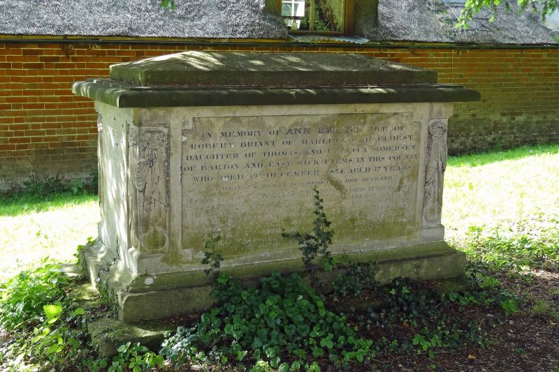
Entry Name: Briant Monument in Churchyard, 15 Metres South of South Porch, Church of St Andrew
Listing Date: 30 October 1987
Grade: II
Source: Historic England
Source ID: 1193650
English Heritage Legacy ID: 311877
ID on this website: 101193650
Location: St Andrew's Church, Wootton Rivers, Wiltshire, SN8
County: Wiltshire
Civil Parish: Wootton Rivers
Traditional County: Wiltshire
Lieutenancy Area (Ceremonial County): Wiltshire
Tagged with: Monument
WOOTTON RIVERS -
SU 16 SE
6/242 Briant monument in churchyard,
15m south of south porch, Church
of St. Andrew
II
Tall chest tomb. Early C19. Limestone. Table with inset
hipped centre section. Corner balusters with drapery. Panel to
Ann Briant, died 1834 and family.
Listing NGR: SU1968262930
External links are from the relevant listing authority and, where applicable, Wikidata. Wikidata IDs may be related buildings as well as this specific building. If you want to add or update a link, you will need to do so by editing the Wikidata entry.


Other nearby listed buildings
