Latitude: 51.5174 / 51°31'2"N
Longitude: -0.0787 / 0°4'43"W
OS Eastings: 533407
OS Northings: 181583
OS Grid: TQ334815
Mapcode National: GBR VB.G6
Mapcode Global: VHGR0.L482
Plus Code: 9C3XGW8C+XG
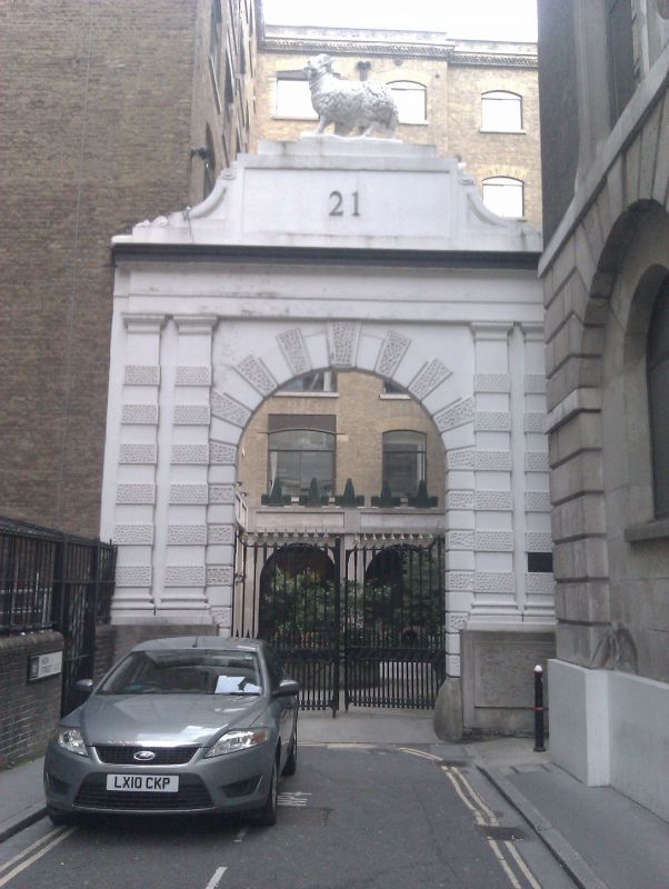
Entry Name: Gateway to Number 21
Listing Date: 5 June 1972
Grade: II
Source: Historic England
Source ID: 1194082
English Heritage Legacy ID: 199666
ID on this website: 101194082
Location: Spitalfields, City of London, London, EC2M
County: London
District: City and County of the City of London
Electoral Ward/Division: Bishopsgate
Parish: Non Civil Parish
Built-Up Area: City of London
Traditional County: Middlesex
Lieutenancy Area (Ceremonial County): City of London
Church of England Parish: St Botolph without Bishopsgate
Church of England Diocese: London
Tagged with: Gate
1. 5002 NEW STREET EC2 (North Side)
Gateway to No 21 TQ 3381 NW 5/50 5.6.72.
II
2. Mid C19. Stuccoed archway with pairs of rusticated Doric pilasters supporting entablature. High blocking flanked by consoles, supporting figure of ram.
Listing NGR: TQ3340881583
External links are from the relevant listing authority and, where applicable, Wikidata. Wikidata IDs may be related buildings as well as this specific building. If you want to add or update a link, you will need to do so by editing the Wikidata entry.


Other nearby listed buildings