Latitude: 51.3509 / 51°21'3"N
Longitude: -1.6657 / 1°39'56"W
OS Eastings: 423378
OS Northings: 161361
OS Grid: SU233613
Mapcode National: GBR 5ZF.CP4
Mapcode Global: VHC23.29SS
Plus Code: 9C3W982M+8P
Entry Name: 26, Eastcourt Road
Listing Date: 20 November 1985
Grade: II
Source: Historic England
Source ID: 1194411
English Heritage Legacy ID: 312228
ID on this website: 101194411
Location: Burbage, Wiltshire, SN8
County: Wiltshire
Civil Parish: Burbage
Built-Up Area: Burbage
Traditional County: Wiltshire
Lieutenancy Area (Ceremonial County): Wiltshire
Tagged with: Building Thatched cottage
BURBAGE EASTCOURT ROAD SU 26 SW (west side) 2/19 No 26 20.11.85 II
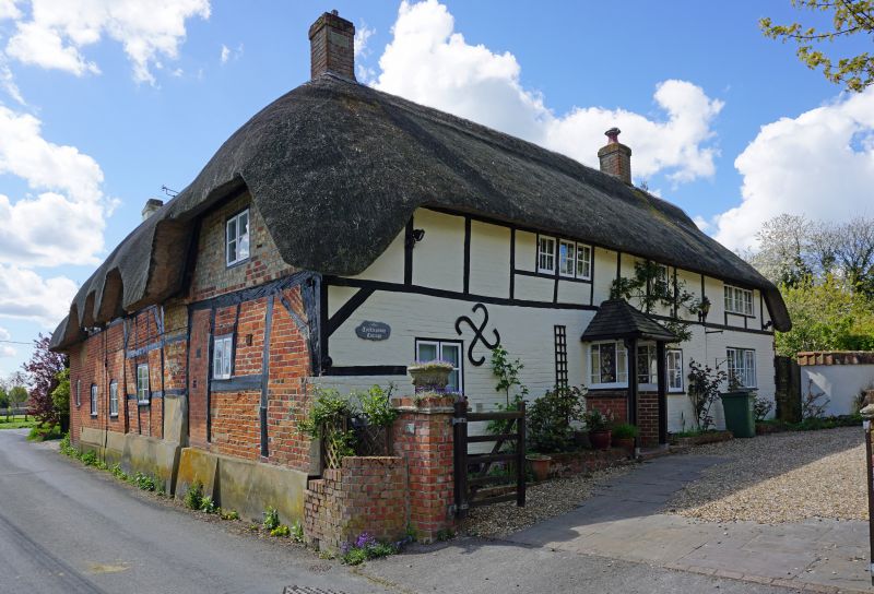
House. C16, 1669 and C18. Timber framed with brick noggings, thatched roof. Originally single storey and attic set gable end to street, later, probably in 1669, raised to 2 storeys and extended south along road by 1 bay plus stack bay forming 'L' plan, single storey and attic from start. West gable rebuilt in C20. Framing 2 panels high with jowled posts and straight corner braces. C20 door in right side of centre bay on north, within C20 open porch. Two light timber casement windows, 3-light to mid C17 raising of walls. Roof half-hipped to left. Interior has 2 cross walls and original rafters without smoke blackening, suggesting probably there was always a chimney in left hand bay. Clasped purlin roof. Large fireplace with timber lintel and oven in left bay. Cruck-like corner posts exposed externally at gable ends The house was a cooper's shop and barn in the C19.
Listing NGR: SU2337861361
External links are from the relevant listing authority and, where applicable, Wikidata. Wikidata IDs may be related buildings as well as this specific building. If you want to add or update a link, you will need to do so by editing the Wikidata entry.


Other nearby listed buildings