Latitude: 52.6827 / 52°40'57"N
Longitude: -1.8203 / 1°49'13"W
OS Eastings: 412244
OS Northings: 309459
OS Grid: SK122094
Mapcode National: GBR 4DN.W1F
Mapcode Global: WHCGP.0TGR
Plus Code: 9C4WM5MH+3V
Entry Name: Numbers 59-67 (Odd) and Attached Walls
Listing Date: 31 March 1993
Grade: II
Source: Historic England
Source ID: 1194888
English Heritage Legacy ID: 382707
ID on this website: 101194888
Location: Lichfield, Staffordshire, WS13
County: Staffordshire
District: Lichfield
Civil Parish: Lichfield
Built-Up Area: Lichfield
Traditional County: Staffordshire
Lieutenancy Area (Ceremonial County): Staffordshire
Church of England Parish: Lichfield St Michael and St Mary
Church of England Diocese: Lichfield
Tagged with: Building
LICHFIELD
SK10NW ROTTEN ROW 1094-1/3/147 (North West side) 31/03/93 Nos.59-67 (Odd) and attached walls
GV II
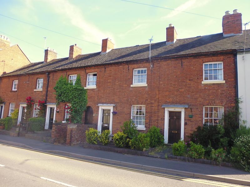
Terrace of 5 houses. c1830. Brick; tile roof with 6 brick stacks. Georgian style. 2 storeys; 6-window range. Top modillioned brick cornice. Entrances to left of windows have doorcases with panelled pilaster strips, friezes and cornices, 6-fielded-panel doors, but No.61 has half-glazed door; round-headed entry to right of No.63 has plank door. Windows have sills, and rubbed brick flat arches over 16-pane sashes to ground floor, 4/8-pane sashes to 1st floor. 4 cross-axial stacks and 2 end stacks. Attached brick walls flank path to entry; brick steps and front garden walls.
Listing NGR: SK1224409459
External links are from the relevant listing authority and, where applicable, Wikidata. Wikidata IDs may be related buildings as well as this specific building. If you want to add or update a link, you will need to do so by editing the Wikidata entry.


Other nearby listed buildings