Latitude: 52.8071 / 52°48'25"N
Longitude: -2.115 / 2°6'54"W
OS Eastings: 392343
OS Northings: 323289
OS Grid: SJ923232
Mapcode National: GBR 288.0E5
Mapcode Global: WHBDT.HP2W
Plus Code: 9C4VRV4M+RX
Entry Name: The Colonnade Tudor House
Listing Date: 16 February 1994
Grade: II
Source: Historic England
Source ID: 1195380
English Heritage Legacy ID: 383952
ID on this website: 101195380
Location: Stafford, Staffordshire, ST16
County: Staffordshire
District: Stafford
Electoral Ward/Division: Forebridge
Parish: Non Civil Parish
Built-Up Area: Stafford
Traditional County: Staffordshire
Lieutenancy Area (Ceremonial County): Staffordshire
Church of England Parish: Stafford St Mary
Church of England Diocese: Lichfield
Tagged with: House
STAFFORD
SJ9223SW EASTGATE STREET 590-1/10/11 (North East side) No.9 The Colonnade and Tudor House
GV II
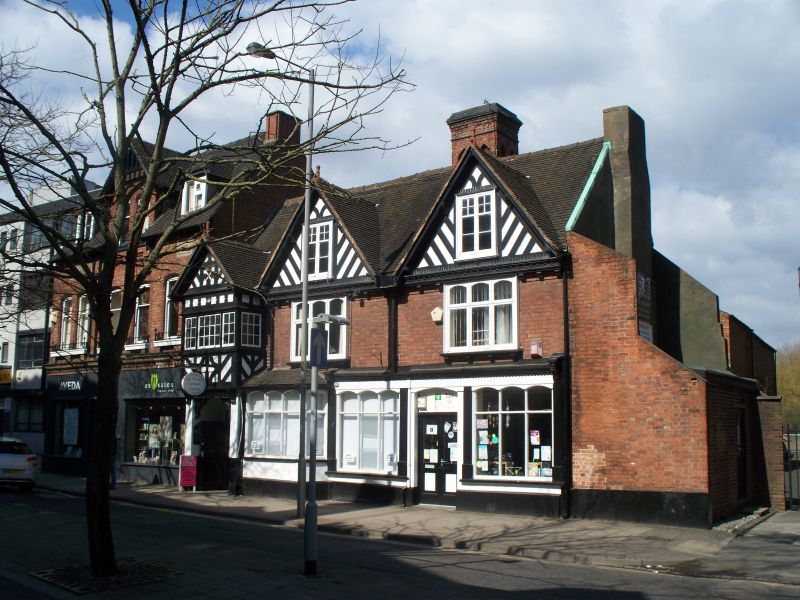
House, now 5 shops. Probably C17 with late C19 alterations; dated 1560. Brick with some square-panel timber-framing; tile roof with brick stacks. EXTERIOR: 2 storeys with attic; 3-window range. Ground floor has 2 shopfronts with bay window to left and fascia over; left end entry with studded inner door in 2-storey gabled porch; 1st floor has timber-framing to jettied porch, with small-paned casements to 3 sides; 2 projecting 3-light casement windows to right; attic has 2 windows in timber-framed gables. Plastered end stack. Rear has gabled wing; right return has exposed timber-framing to 1st floor and, possibly, plastered wall posts to lower addition; inner return has C20 shopfronts; cross-casement to 1st floor and riven rafters; end chequer brick gable. INTERIOR: ground floor has ovolo-moulded beams and some C17 panelling to front shop; records of vacant 1st floor mention more panelling, some with round-headed panels, and stone fireplace; roof with collar trusses with tie beams and queen struts and wind braces; timber-framed gable end with triple diagonal braces. (County Photograph Collection; County Planning Department: County Sites & Monuments Record).
Listing NGR: SJ9234323289
External links are from the relevant listing authority and, where applicable, Wikidata. Wikidata IDs may be related buildings as well as this specific building. If you want to add or update a link, you will need to do so by editing the Wikidata entry.


Other nearby listed buildings