Latitude: 52.8113 / 52°48'40"N
Longitude: -2.1205 / 2°7'13"W
OS Eastings: 391971
OS Northings: 323762
OS Grid: SJ919237
Mapcode National: GBR 16Q.QPQ
Mapcode Global: WHBDT.DLGM
Plus Code: 9C4VRV6H+GQ
Entry Name: 62 and 63, Foregate Street
Listing Date: 17 December 1971
Grade: II
Source: Historic England
Source ID: 1195383
English Heritage Legacy ID: 383965
ID on this website: 101195383
Location: Broadeye, Stafford, Staffordshire, ST16
County: Staffordshire
District: Stafford
Electoral Ward/Division: Coton
Parish: Non Civil Parish
Built-Up Area: Stafford
Traditional County: Staffordshire
Lieutenancy Area (Ceremonial County): Staffordshire
Church of England Parish: Stafford St Mary
Church of England Diocese: Lichfield
Tagged with: Building
STAFFORD
SJ9123 FOREGATE STREET 590-1/5/23 (East side) 17/12/71 Nos.62 AND 63
II
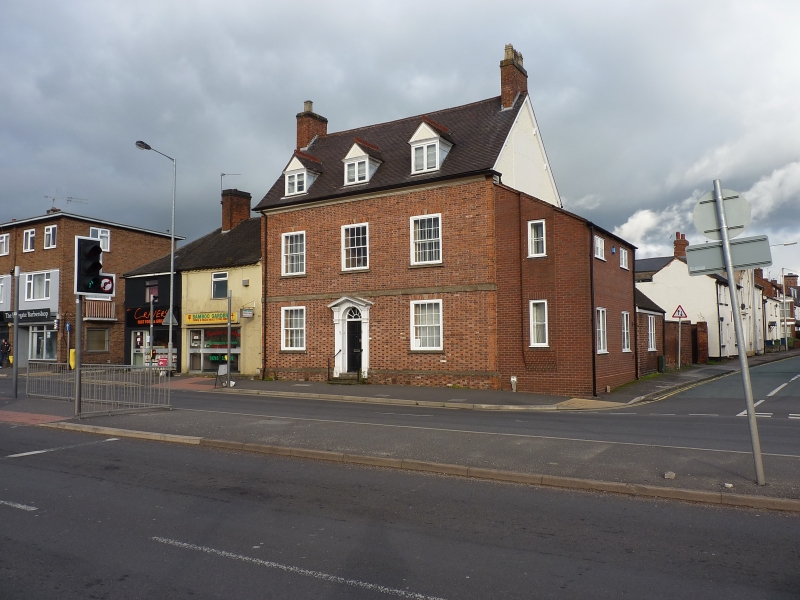
House, now office. c1698; front elevation rebuilt late C20; extensively refurbished. Chequer brick with ashlar dressings; internally central bay flanked by timber-framed cross walls; tile roof with brick end stacks. Double-depth plan. Georgian style. 2 storeys with attic; symmetrical 3-window range. Stone-coped plinth; stone platt band over ground floor and coved cornice. C20 round-headed entrance has doorcase with fluted pilasters, entablatures and pedimental hood, fanlight with radial glazing bars over 6-fielded-panel door. Windows have sills, and brick flat arches over 16-pane sashes; 3 gabled dormers with casements. C20 lean-to addition to right replacing original lean-to. Rear has gabled wing and single-storey C20 wing and lean-to outshut; some segmental-headed casement windows and skylights. INTERIOR retains chamfered beams and curved roof trusses suggesting original barrel-vaulted ceiling; forge to smithy of c1798. (Information held by Sutton Housing Trust).
Listing NGR: SJ9197123762
External links are from the relevant listing authority and, where applicable, Wikidata. Wikidata IDs may be related buildings as well as this specific building. If you want to add or update a link, you will need to do so by editing the Wikidata entry.


Other nearby listed buildings