Latitude: 52.8078 / 52°48'28"N
Longitude: -2.1199 / 2°7'11"W
OS Eastings: 392017
OS Northings: 323368
OS Grid: SJ920233
Mapcode National: GBR 16Q.YPP
Mapcode Global: WHBDT.DPSB
Plus Code: 9C4VRV5J+43
Entry Name: 2, Mount Street
Listing Date: 17 December 1971
Grade: II
Source: Historic England
Source ID: 1195361
English Heritage Legacy ID: 384022
ID on this website: 101195361
Location: Broadeye, Stafford, Staffordshire, ST16
County: Staffordshire
District: Stafford
Electoral Ward/Division: Forebridge
Parish: Non Civil Parish
Built-Up Area: Stafford
Traditional County: Staffordshire
Lieutenancy Area (Ceremonial County): Staffordshire
Church of England Parish: Stafford St Mary
Church of England Diocese: Lichfield
Tagged with: Building
STAFFORD
SJ9223SW MOUNT STREET 590-1/10/73 (West side) 17/12/71 No.2
GV II
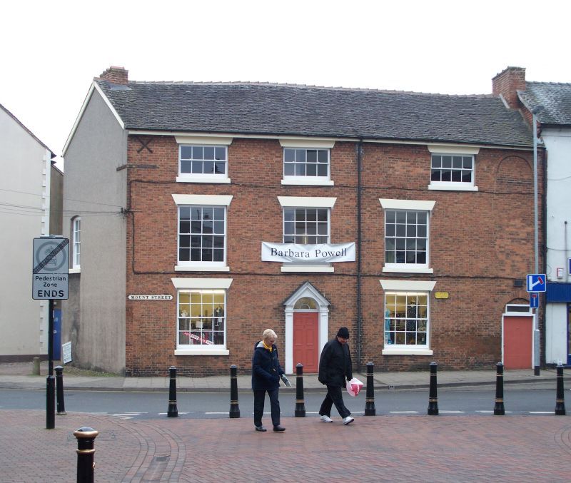
House, now office. c1810, with partly C17 rear wing. Brick with stucco dressings; tile roof with brick end stacks. Georgian style. EXTERIOR: 3 storeys; 3-window range; partly symmetrical composition. Right end has blocked round arch to 2nd floor suggesting loading bay, round-headed entrance below with C20 door and overlight; central entrance has doorcase with fluted pilasters, entablature blocks and open dentilled pediment; fanlight with glazing bars over board-clad door. Windows have sills and wedge lintels; those to ground and 1st floors have 16-pane sashes; those to 2nd floor have 8-pane sashes, the window to right end is further to right than those to lower floors. Segmental-headed sashed window to left return. Rear is plastered with modillioned brick cornice and has gabled wing, originally of 2 storeys, with very worn and blocked 4-light stone chamfered-mullioned window; varied fenestration to left return, small-paned casements to top floor; lean-to outshut to right.
Listing NGR: SJ9201323368
External links are from the relevant listing authority and, where applicable, Wikidata. Wikidata IDs may be related buildings as well as this specific building. If you want to add or update a link, you will need to do so by editing the Wikidata entry.


Other nearby listed buildings