Latitude: 51.5428 / 51°32'34"N
Longitude: -0.0957 / 0°5'44"W
OS Eastings: 532150
OS Northings: 184373
OS Grid: TQ321843
Mapcode National: GBR Q1.N4
Mapcode Global: VHGQT.9H74
Plus Code: 9C3XGWV3+4P
Entry Name: 23-29, Canonbury Grove
Listing Date: 29 September 1972
Last Amended: 30 September 1994
Grade: II
Source: Historic England
Source ID: 1195496
English Heritage Legacy ID: 368629
ID on this website: 101195496
Location: Canonbury, Islington, London, N1
County: London
District: Islington
Electoral Ward/Division: Canonbury
Parish: Non Civil Parish
Built-Up Area: Islington
Traditional County: Middlesex
Lieutenancy Area (Ceremonial County): Greater London
Church of England Parish: St Stephen Canonbury
Church of England Diocese: London
Tagged with: Building
ISLINGTON
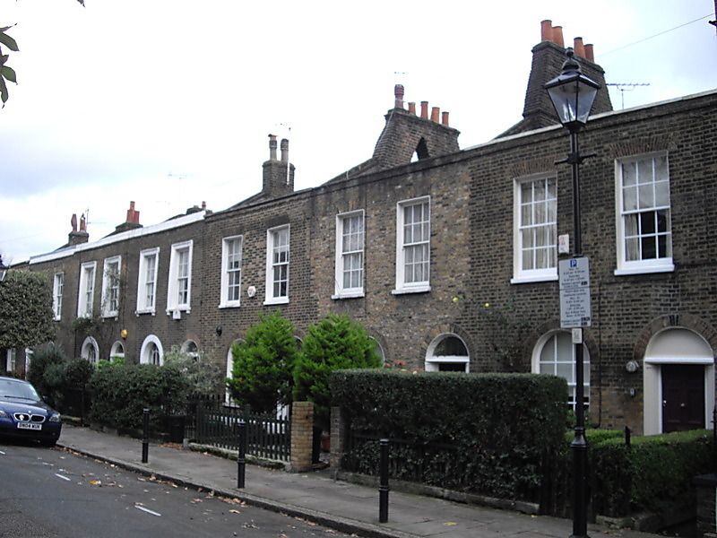
TQ3284SW CANONBURY GROVE 635-1/54/140 (South East side) 29/09/72 Nos.23-29 (Consecutive) (Formerly Listed as: CANONBURY GROVE Nos.13-29 (Consecutive))
GV II
Terraced houses. c.1825. Developed by Richard Laycock. Yellow-brown brick set in Flemish bond, stucco, roofs of Welsh and artificial slate. Two storeys, two windows each except no 29, which has three windows and is double-fronted. Ground-floor openings round-arched with gauged brick heads. Entrance with fluted quarter-columns, cornice and fanlight (fanlights lacking on nos 23 and 29), panelled doors to nos 28 and 29. Sashes with radiating glazing bars to nos 25-8, stucco architraves to nos 26-7. Upper windows flat-arched with gauged brick heads; 6/6 sashes to nos 23-28; nos 26-7 have moulded stucco architraves. Parapet. Party walls project carrying stacks, those to nos 23-5 rebuilt as double arched stacks. No 29 much rebuilt at the back. (Historians' file, English Heritage London Division).
Listing NGR: TQ3215084373
External links are from the relevant listing authority and, where applicable, Wikidata. Wikidata IDs may be related buildings as well as this specific building. If you want to add or update a link, you will need to do so by editing the Wikidata entry.


Other nearby listed buildings