Latitude: 51.5205 / 51°31'13"N
Longitude: -0.0861 / 0°5'10"W
OS Eastings: 532881
OS Northings: 181906
OS Grid: TQ328819
Mapcode National: GBR S9.S4
Mapcode Global: VHGR0.G1BR
Plus Code: 9C3XGWC7+5G
Entry Name: Cattle Trough
Listing Date: 30 September 1994
Grade: II
Source: Historic England
Source ID: 1195592
English Heritage Legacy ID: 368896
ID on this website: 101195592
Location: Shoreditch, Islington, London, EC2A
County: London
District: Islington
Electoral Ward/Division: Bunhill
Parish: Non Civil Parish
Built-Up Area: Islington
Traditional County: Middlesex
Lieutenancy Area (Ceremonial County): Greater London
Church of England Parish: St Giles Cripplegate
Church of England Diocese: London
Tagged with: Manger
ISLINGTON
TQ3281NE FINSBURY SQUARE
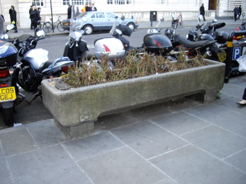
635-1/79/1021 Cattle Trough
II
Cattle trough approxiamately 12 metre south of drinking
fountain. 1899. Granite bowl on granite supports. Inscription
to Martha Smith.
Listing NGR: TQ3288181906
External links are from the relevant listing authority and, where applicable, Wikidata. Wikidata IDs may be related buildings as well as this specific building. If you want to add or update a link, you will need to do so by editing the Wikidata entry.


Other nearby listed buildings