Latitude: 51.5254 / 51°31'31"N
Longitude: -0.1055 / 0°6'19"W
OS Eastings: 531524
OS Northings: 182426
OS Grid: TQ315824
Mapcode National: GBR N7.GB
Mapcode Global: VHGQT.4X2G
Plus Code: 9C3XGVGV+5R
Entry Name: 49, Skinner Street
Listing Date: 29 September 1972
Grade: II
Source: Historic England
Source ID: 1195758
English Heritage Legacy ID: 369356
ID on this website: 101195758
Location: Clerkenwell, Islington, London, EC1R
County: London
District: Islington
Electoral Ward/Division: Clerkenwell
Parish: Non Civil Parish
Built-Up Area: Islington
Traditional County: Middlesex
Lieutenancy Area (Ceremonial County): Greater London
Church of England Parish: St James Clerkenwell
Church of England Diocese: London
Tagged with: Building
ISLINGTON
TQ3182SE SKINNER STREET 635-1/74/771 (South side) 29/09/72 No.49
GV II
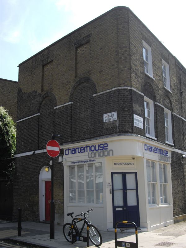
Terraced house and shop. Early C19. Yellow brick set in Flemish bond, roof obscured by parapet. Three storeys, two-window range to Woodbridge Street, two to Skinner Street (the latter both blank), slightly recessed curve to corner. Ground floor has C19 shopfront with surviving fascia and cornice with egg-and-dart moulding. Round-arched entrance in Skinner Street with pilaster jambs and cornice. Stucco storey band to first floor.First-floor windows flat-arched to Woodbridge Street and set back under round arches of gauged brick, linked by stucco springing band to blank windows in Skinner Street; second-floor windows flat-arched with gauged brick heads; parapet; stack to party wall.
Listing NGR: TQ3152682424
External links are from the relevant listing authority and, where applicable, Wikidata. Wikidata IDs may be related buildings as well as this specific building. If you want to add or update a link, you will need to do so by editing the Wikidata entry.


Other nearby listed buildings