Latitude: 53.0037 / 53°0'13"N
Longitude: -2.1819 / 2°10'54"W
OS Eastings: 387888
OS Northings: 345169
OS Grid: SJ878451
Mapcode National: GBR MKK.7R
Mapcode Global: WHBCT.GR6N
Plus Code: 9C5V2R39+F6
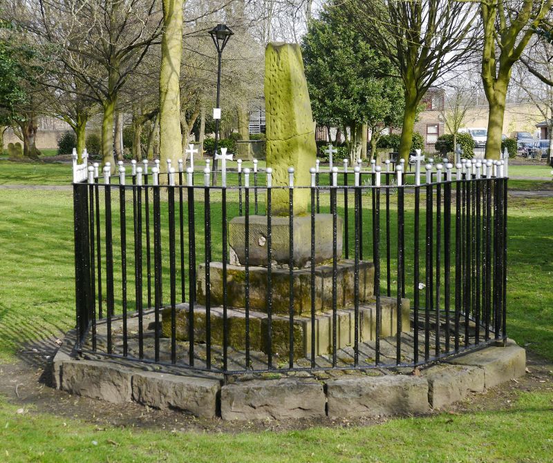
Entry Name: Cross Fragment in St Peter's Churchyard
Listing Date: 2 October 1951
Last Amended: 15 March 1993
Grade: II
Source: Historic England
Source ID: 1195794
English Heritage Legacy ID: 384405
ID on this website: 101195794
Location: St Peter's Church, Stoke-upon-Trent, Stoke-on-Trent, Staffordshire, ST4
County: City of Stoke-on-Trent
Electoral Ward/Division: Penkhull and Stoke
Parish: Non Civil Parish
Built-Up Area: Stoke-on-Trent
Traditional County: Staffordshire
Lieutenancy Area (Ceremonial County): Staffordshire
Church of England Parish: Stoke upon Trent and Fenton
Church of England Diocese: Lichfield
STOKE ON TRENT
SJ8645 GLEBE STREET 613-1/9/124 (South East side) 02/10/51 Cross fragment in St Peter's Churchyard (Formerly Listed as: GLEBE STREET Churchyard Cross)
GV II
Fragment of Anglo-Saxon cross. Stone. Identified by Charles Lynam and re-erected by him in mid C19. Tooled base and surrounding railings are mid C19, and the shaft itself, which is some 4 ft high, is enriched with interlace and key patterns. (Baynton V: Charles Lynan and his Work: University of Keele: 1980-).
Listing NGR: SJ8788845169


Other nearby listed buildings