Latitude: 53.0034 / 53°0'12"N
Longitude: -2.1814 / 2°10'52"W
OS Eastings: 387924
OS Northings: 345133
OS Grid: SJ879451
Mapcode National: GBR MKK.CW
Mapcode Global: WHBCT.GRGX
Plus Code: 9C5V2R39+9C
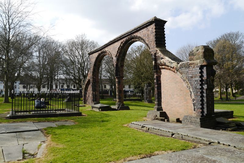
Entry Name: Ruins of Earlier Church in St Peter's Churchyard
Listing Date: 2 October 1951
Grade: II
Source: Historic England
Source ID: 1195795
English Heritage Legacy ID: 384407
ID on this website: 101195795
Location: St Peter's Church, Stoke-upon-Trent, Stoke-on-Trent, Staffordshire, ST4
County: City of Stoke-on-Trent
Electoral Ward/Division: Penkhull and Stoke
Parish: Non Civil Parish
Built-Up Area: Stoke-on-Trent
Traditional County: Staffordshire
Lieutenancy Area (Ceremonial County): Staffordshire
Church of England Parish: Stoke upon Trent and Fenton
Church of England Diocese: Lichfield
Tagged with: Architectural structure
STOKE ON TRENT
SJ8645 GLEBE STREET 613-1/9/121 (South East side) 02/10/51 Ruins of Earlier Church in St Peter's Churchyard
GV II
Ruins of earlier church, re-assembled by Charles Lynam in c1881. Two moulded stone arches with polygonal responds and cylindrical central shaft, with flying buttress to west infilled with brick, and with tiled coping over. Remains of another shaft further east, and stone footings marking the site of the altar. The former church was demolished, and the stones were subsequently rediscovered by Charles Lynam, who re-erected them on their approximate original site. (A History of the Church and Ancient Parish of Stoke-upon-Trent: Talbot R).
Listing NGR: SJ8792445133
External links are from the relevant listing authority and, where applicable, Wikidata. Wikidata IDs may be related buildings as well as this specific building. If you want to add or update a link, you will need to do so by editing the Wikidata entry.


Other nearby listed buildings