Latitude: 52.9009 / 52°54'3"N
Longitude: -2.1457 / 2°8'44"W
OS Eastings: 390297
OS Northings: 333728
OS Grid: SJ902337
Mapcode National: GBR 15Q.4BL
Mapcode Global: WHBDF.0BJY
Plus Code: 9C4VWV23+9P
Entry Name: 10, 12 and 16, Stafford Street
Listing Date: 24 January 1992
Grade: II
Source: Historic England
Source ID: 1196753
English Heritage Legacy ID: 386031
ID on this website: 101196753
Location: Stone, Stafford, Staffordshire, ST15
County: Staffordshire
District: Stafford
Civil Parish: Stone
Built-Up Area: Stone
Traditional County: Staffordshire
Lieutenancy Area (Ceremonial County): Staffordshire
Church of England Parish: Stone St Michael and St Wulfad
Church of England Diocese: Lichfield
Tagged with: Building
STONE
SJ9033 STAFFORD STREET, Stone 651-1/7/55 (East side) Nos.10, 12 AND 16
GV II
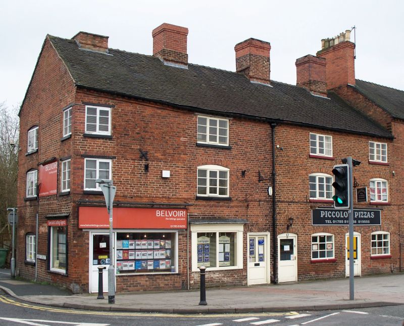
Row of 4 shops. Mid to late C18. Brick; tile roof with brick stacks. 3 storeys; 4-window range. Top brick cornice. Left end C20 shop fronts to left and right ends; shop window to left of centre has frieze and cornice, entrance to right has altered rubbed brick cambered arch over glazed door; entrance and window to right of centre have rubbed brick cambered arches,small-paned casement. Windows to upper floors have sills and small-paned casements, some with iron opening casements, those to 1st floor with rubbed brick cambered arches, but left end has inserted small casement to each floor. 4 large cross-axial stacks, one truncated, the others part rebuilt. Rear similar with round-headed casement windows.
Listing NGR: SJ9029733727
External links are from the relevant listing authority and, where applicable, Wikidata. Wikidata IDs may be related buildings as well as this specific building. If you want to add or update a link, you will need to do so by editing the Wikidata entry.


Other nearby listed buildings