Latitude: 52.0522 / 52°3'8"N
Longitude: -2.7171 / 2°43'1"W
OS Eastings: 350920
OS Northings: 239559
OS Grid: SO509395
Mapcode National: GBR FL.DSQG
Mapcode Global: VH85N.VPF3
Plus Code: 9C4V372M+V4
Entry Name: Tara House, Barn and Warehouse, Shed and Attached Rubble Wall
Listing Date: 22 October 1973
Grade: II
Source: Historic England
Source ID: 1196900
English Heritage Legacy ID: 372535
ID on this website: 101196900
Location: Blackmarstone, County of Herefordshire, HR2
County: County of Herefordshire
Civil Parish: Hereford
Built-Up Area: Hereford
Traditional County: Herefordshire
Lieutenancy Area (Ceremonial County): Herefordshire
Church of England Parish: Hereford St Martin with St Francis
Church of England Diocese: Hereford
Tagged with: Architectural structure
HEREFORD
SO5039NE WYE STREET 683-1/2/351 (North side) 22/10/73 No.14 Tara House, barn and warehouse, shed and attached rubble wall
GV II
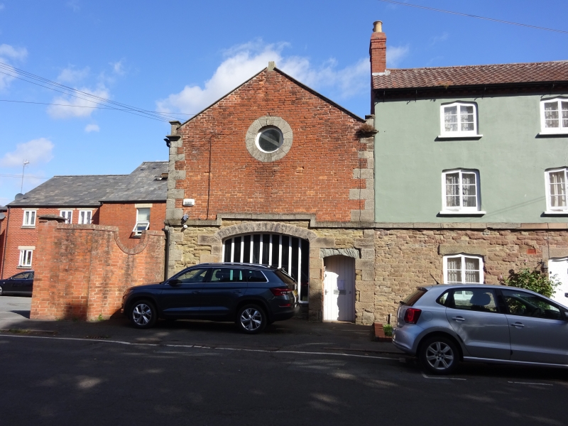
House, stable block and perimeter wall. Early to mid C19. Coursed stone rubble to ground floor; rendered brick over; pantile roof; brick end stacks. 3 storeys; 3-window range: ogee-headed 2-light casements with horizontal glazing bars under depressed-ogee heads, to 1st and 2nd floors; brick modillion eaves. Central entrance: studded plank door in ogee-headed case, under stone lintel; flanked by similar casements; stone storeyband. Right returned side: dressed stone quoins to front. To left, rubble warehouse with brick loft: pierced plank double doors under stone segmental arch and continuing shouldered storeyband; brick blocked opening under stone lintel; circular light over; dressed stone detailing; corrugated-asbestos roof. Left returned side has 2 casements to 1st floor, 1 in dressed stone quoins; coved stone eaves. Rear (river) elevation has round-headed light with plank riser, in quoined stone arch, over C20 door under stone lintel; stone bands and dressings. To right of house, coursed rubble shed with weatherboarded gable: rubble wall returned to side and rear, which has 2 stone arches. INTERIOR: mid C19 dogleg staircase with stick balusters.
Listing NGR: SO5092039559
External links are from the relevant listing authority and, where applicable, Wikidata. Wikidata IDs may be related buildings as well as this specific building. If you want to add or update a link, you will need to do so by editing the Wikidata entry.


Other nearby listed buildings