Latitude: 54.8741 / 54°52'26"N
Longitude: -2.902 / 2°54'7"W
OS Eastings: 342216
OS Northings: 553637
OS Grid: NY422536
Mapcode National: GBR 8D52.JK
Mapcode Global: WH803.DRB8
Plus Code: 9C6VV3FX+M5
Entry Name: Milestone Outside Number 405
Listing Date: 11 April 1994
Grade: II
Source: Historic England
Source ID: 1196926
English Heritage Legacy ID: 386785
ID on this website: 101196926
Location: Harraby, Cumberland, Cumbria, CA1
County: Cumberland
District: Carlisle
Parish: Non Civil Parish
Built-Up Area: Carlisle
Traditional County: Cumberland
Lieutenancy Area (Ceremonial County): Cumbria
Church of England Parish: Carlisle, Harraby St Elizabeth
Church of England Diocese: Carlisle
Tagged with: Milestone
CARLISLE
NY45SW LONDON ROAD 671-1/16/195 (East side) Milestone outside No.405
II
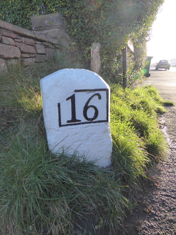
Milestone. Early C19 for the Carlisle to Eamont Bridge Turnpike. Whitewashed stone and cast-iron plates. Squared stone with roughly rounded top, set at angle with plates facing north and south which are just a number picked out in black; 16 (miles to Penrith) and 2 (miles to Carlisle).
Listing NGR: NY4221653637
External links are from the relevant listing authority and, where applicable, Wikidata. Wikidata IDs may be related buildings as well as this specific building. If you want to add or update a link, you will need to do so by editing the Wikidata entry.


Other nearby listed buildings