Latitude: 54.897 / 54°53'49"N
Longitude: -2.94 / 2°56'23"W
OS Eastings: 339814
OS Northings: 556211
OS Grid: NY398562
Mapcode National: GBR 7CXT.9C
Mapcode Global: WH802.T56Q
Plus Code: 9C6VV3W6+Q2
Entry Name: Fragment of North City Walls Adjoining South East Angle
Listing Date: 1 June 1949
Grade: I
Source: Historic England
Source ID: 1197001
English Heritage Legacy ID: 386573
ID on this website: 101197001
Location: Carlisle, Cumberland, Cumbria, CA3
County: Cumberland
District: Carlisle
Parish: Non Civil Parish
Built-Up Area: Carlisle
Traditional County: Cumberland
Lieutenancy Area (Ceremonial County): Cumbria
Church of England Parish: Carlisle St Cuthbert with St Mary
Church of England Diocese: Carlisle
Tagged with: City walls
CARLISLE
NY3956SE CARLISLE CASTLE 671-1/6/3 Fragment of north City Walls 01/06/49 adjoining south-east angle
GV I
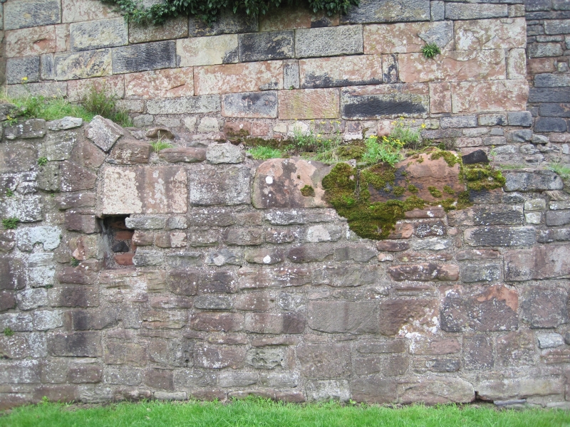
Fragment of north city walls. C12 with extensive repairs of different periods up to 1973. Squared blocks of red sandstone with some calciferous sandstone and some re-used Roman stone; partly on chamfered plinth with partly flagged parapet walk and rounded coping. High thick wall zig-zagged down slope, partly stepped. Where the wall turns up at a sharp angle there is a C12 sallyport with rounded arch, blocked in similar materials to the wall at an early date. Further down the wall is a projecting oriel C15 or C16 canted turret, now supported by C19 buttress. Towards the demolished end of the wall it has been reduced in height and some stone replaced in 1973 to fill previous gap. At the rear of the wall, part of the parapet walk over the Castle moat has been cut away (probably in 1819); in other places the paving has gone from the walk. Wall was used as a retaining wall for gardens on Finkle Street and build-up of soil caused large crack still evident; soil removed in 1972. Remainder of north walls demolished between 1811 and 1815. Remains standing over 2 metres high survive beneath street level of West Tower Street (excavated 1973). For full details see McCarthy et al (1990).
Listing NGR: NY3981656210
External links are from the relevant listing authority and, where applicable, Wikidata. Wikidata IDs may be related buildings as well as this specific building. If you want to add or update a link, you will need to do so by editing the Wikidata entry.


Other nearby listed buildings