Latitude: 54.8972 / 54°53'50"N
Longitude: -2.9414 / 2°56'29"W
OS Eastings: 339722
OS Northings: 556238
OS Grid: NY397562
Mapcode National: GBR 7CWT.Z8
Mapcode Global: WH802.S5JK
Plus Code: 9C6VV3W5+VC
Entry Name: Captains Tower and Inner Bailey Walls
Listing Date: 1 June 1949
Grade: I
Source: Historic England
Source ID: 1297368
English Heritage Legacy ID: 386582
ID on this website: 101297368
Location: Caldewgate, Cumberland, Cumbria, CA3
County: Cumberland
District: Carlisle
Parish: Non Civil Parish
Built-Up Area: Carlisle
Traditional County: Cumberland
Lieutenancy Area (Ceremonial County): Cumbria
Church of England Parish: Carlisle St Cuthbert with St Mary
Church of England Diocese: Carlisle
Tagged with: Tower
CARLISLE
NY3956SE CARLISLE CASTLE 671-1/6/13 Captains Tower and Inner Bailey 01/06/49 Walls
GV I
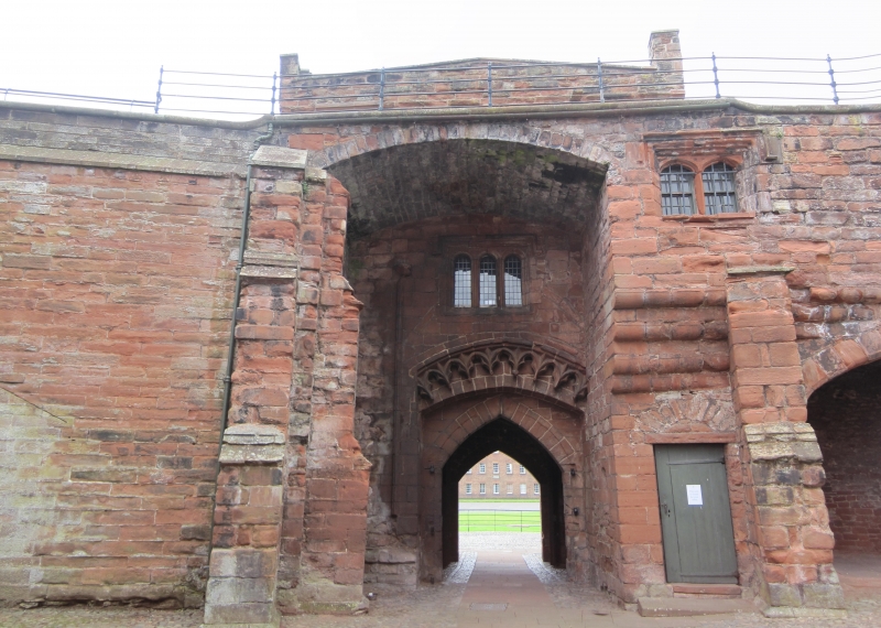
Gate tower and curtain walls. C12 walls, C13 tower with C14 modifications and some C19 alterations; walls partly rebuilt 1821-4 and 1834-5. Squared blocks of red and calciferous sandstone; walls battered, partly buttressed and partly with broad pilasters; tower with buttress, pilasters and flat lead roof. The inner bailey is roughly triangular comprising north, south and west walls. The west walls face into the outer bailey and have a central 3-storey square tower (an earlier blocked gateway can also be seen in this wall). At the front of the tower the portcullis slot and platform above have been cut away (c1919), exposing a pointed archway under 1819 blocked doorway and windows. Crenellation was also removed in 1819. The rear of the arch has blind C14 tracery under a Tudor mullioned window. INTERIOR not inspected. North wall is extensively buttressed (these partly collapsed in 1821 and had to be rebuilt). On the angle of the south and north walls was Queen Mary's Tower which had to be demolished in 1834-5 and rebuilt in 1835 with a plain crenellated wall. South walls look C12 with broad pilasters. Behind the west and south walls are earth embankments to take guns and a broad stepped ramp gives access to the west wall; beneath the northern part of the west walls are arched casements. The north parapet wall retains two C18 24-pounder cannons. For full details see McCarthy et al (1990).
Listing NGR: NY3972256238
External links are from the relevant listing authority and, where applicable, Wikidata. Wikidata IDs may be related buildings as well as this specific building. If you want to add or update a link, you will need to do so by editing the Wikidata entry.


Other nearby listed buildings