Latitude: 52.6341 / 52°38'2"N
Longitude: -1.7008 / 1°42'2"W
OS Eastings: 420345
OS Northings: 304080
OS Grid: SK203040
Mapcode National: GBR 4FD.W9F
Mapcode Global: WHCH3.V18Y
Plus Code: 9C4WJ7MX+JM
Entry Name: The Manor House
Listing Date: 11 May 1950
Grade: II
Source: Historic England
Source ID: 1197029
English Heritage Legacy ID: 386534
ID on this website: 101197029
Location: The Leys, Tamworth, Staffordshire, B79
County: Staffordshire
District: Tamworth
Electoral Ward/Division: Castle
Parish: Non Civil Parish
Built-Up Area: Tamworth
Traditional County: Staffordshire
Lieutenancy Area (Ceremonial County): Staffordshire
Church of England Parish: Tamworth St Editha
Church of England Diocese: Lichfield
Tagged with: House
TAMWORTH
SK2004SW LICHFIELD STREET 670-1/6/105 (North side) 11/05/50 No.95 The Manor House
GV II
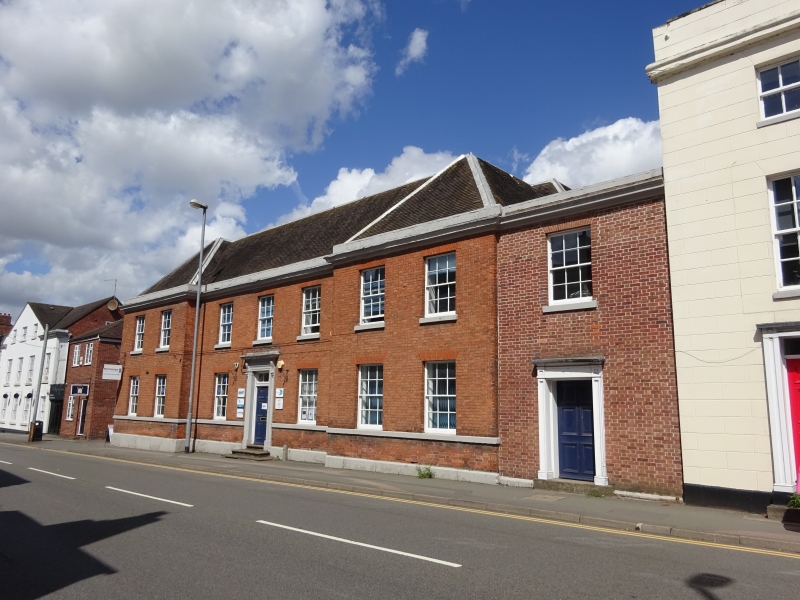
House, now offices. Early C19 remodelling of earlier house, with C17/18 origins. Brick with ashlar dressings; hipped tile roof. Georgian style. Double-depth central-staircase plan. 2 storeys; symmetrical 5-window range, 2 windows to each end in forward breaks. Ashlar plinth, ground floor sill band; top cornice. Entrance up 3 steps has doorcase with architrave, fluted frieze and consoled cornice, overlight to 6-panel door. Windows have rubbed brick flat arches, those to ground floor over 12-pane sashes; 1st floor has windows with sills, and 12-pane top-hung casements. End small single-storey wings have entrances with doorcases, that to left with stone-coped parapet, that to right with segmental-headed window with 12-pane sash. Rear has architraved entrance with large windows to forward break to left with 12-pane sashes. Interior much altered, with stick-baluster stair. Reputed to be the home of Sir Thomas Guy, the founder of Guy's Hospital, London and Guy's Almshouses, Tamworth, who also built the Town Hall (q.v.).
Listing NGR: SK2034504080
External links are from the relevant listing authority and, where applicable, Wikidata. Wikidata IDs may be related buildings as well as this specific building. If you want to add or update a link, you will need to do so by editing the Wikidata entry.


Other nearby listed buildings