Latitude: 51.1328 / 51°7'58"N
Longitude: -3.0066 / 3°0'23"W
OS Eastings: 329664
OS Northings: 137539
OS Grid: ST296375
Mapcode National: GBR M5.8VGZ
Mapcode Global: VH7DH.TSWG
Plus Code: 9C3R4XMV+49
Entry Name: Bridgwater Dock, Tidal Basin, Locks, Quaysides, Bridges and Fittings
Listing Date: 6 June 1973
Last Amended: 31 January 1994
Grade: II
Source: Historic England
Source ID: 1197401
English Heritage Legacy ID: 373956
ID on this website: 101197401
Location: Newtown, Somerset, TA6
County: Somerset
District: Sedgemoor
Civil Parish: Bridgwater
Built-Up Area: Bridgwater
Traditional County: Somerset
Lieutenancy Area (Ceremonial County): Somerset
Tagged with: Architectural structure
BRIDGWATER
ST2937 NORTHGATE 736-1/5/140 (North side) 06/06/73 Bridgwater Dock, Tidal Basin, locks, quaysides, bridges and fittings (Formerly Listed as: NORTHGATE (North side) Bridgwater Dock and Tidal Basin, inc locks, quaysides, fittings & 2 bridges)
GV II
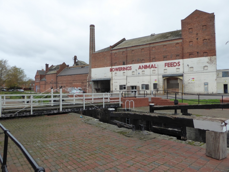
Dock and installations. Opened 1841. By Thomas Maddicks. Blue lias stone, granite, timber and cast-iron. Long rectangular dock to the south-west connected by a lock and bridge to the trapezoid tidal basin to the north-east. The dock walls are of coursed stone, timber upright fenders to south, the quay edges are granite to north and south-east and fronting Wares Warehouse (qv); to south and south-west they are of freestone; the north-west side is C20. The 3 sets of locks, to west into the Bridgwater and Taunton canal, to east into the tidal basin and from it a lock for barges into the River Parrett, are lined with brick. A double-leaf bascule road bridge which worked on the same principle as Tower Bridge London, though this was manually operated, connects the banks between the 2 basins and C20 concrete works have immobilized the wide gates to the ship entrance of the tidal basin which worked as a huge lock. The tidal basin quays are of thin upright freestone blocks, surrounded by many small winches on pedestals with the machinery protected by metal housing, bollards, and railings. The main dock has a cogged base of a crane turntable to the south-west and C20 railings. Flanking the lock between the basins are large winches with chains in cast-iron housings. History: Thomas Dawe Maddicks, b1801 and a relatively unknown engineer, is credited with the work. In 1840 the sluicing and scouring devices designed by him were rare and it is possible the Isambard Kingdom Brunel, who was constructing the railway and had designed Bridgwater Station, may have advised him. The Canal Company built a brick kiln to use some of the clay spoil to make bricks and tiles for the structures associated with the dock. The dock is situated where the River Parrett, navigable for 3-400 ton vessels, joins the Bridgwater-Taunton canal. (Murless B J: Bridgwater Docks and the River Parrett: Bridgwater Somerset: 1983-: 15; Buchanan C A: Guide to Industrial Archaeology of Central Southern England: London: 1980-: 116; VCH: Somerset: London: 1992-: 193).
Listing NGR: ST2966437539
External links are from the relevant listing authority and, where applicable, Wikidata. Wikidata IDs may be related buildings as well as this specific building. If you want to add or update a link, you will need to do so by editing the Wikidata entry.


Other nearby listed buildings