Latitude: 50.8786 / 50°52'42"N
Longitude: -2.9544 / 2°57'15"W
OS Eastings: 332950
OS Northings: 109220
OS Grid: ST329092
Mapcode National: GBR M7.SWX5
Mapcode Global: FRA 46PS.BTG
Plus Code: 9C2VV2HW+C6
Entry Name: Former Joint Railway Station
Listing Date: 29 July 1976
Grade: II
Source: Historic England
Source ID: 1197457
English Heritage Legacy ID: 374112
ID on this website: 101197457
Location: Furnham, Somerset, TA20
County: Somerset
District: South Somerset
Civil Parish: Chard Town
Built-Up Area: Chard
Traditional County: Somerset
Lieutenancy Area (Ceremonial County): Somerset
Church of England Parish: Chard the Good Shepherd Furnham
Church of England Diocese: Bath and Wells
Tagged with: Station building
CHARD
ST30NW GREAT WESTERN ROAD 756-1/1/84 (South side) 29/07/76 Former Joint Railway Station
II
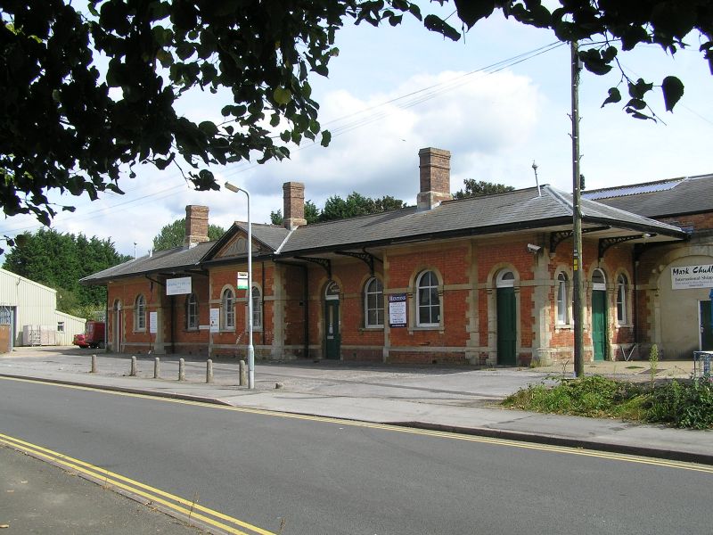
Station building. 1866, for Bristol & Exeter and London & South Western Railways. Flemish bond brick with Bath stone dressings; hipped slate roof, brick ridge stacks. Single storey; 5 bays. Central one, under a pediment with circular ornament, is stepped forward to eaves and is flanked by deeply-recessed bays, each with a door and a window. Outside bays are half-stepped forward with one window between quoins and a door to far left and right. All doors and windows are set in round arches with platband at impost level; windows have bracketed sills and C20 six-pane fixed lights; doors have 4 panels. Shallow-pitched roof with gable to pediment has wide tongued-and-grooved eaves on 3 sides supported by cast-iron brackets resting on keystones of openings in recessed bays. Overhang forms canopy or shelter. INTERIOR not inspected. HISTORY: the station was built to serve the Chard and Taunton Line which was taken over by the Great Western Railway in 1891, a year before the broad gauge track was converted. The station was unique in combining one of Brunel's extended hipped-roofed Italianate brick buildings with one of his wooden overall roofs to the shed (demolished).
Listing NGR: ST3295009220
External links are from the relevant listing authority and, where applicable, Wikidata. Wikidata IDs may be related buildings as well as this specific building. If you want to add or update a link, you will need to do so by editing the Wikidata entry.


Other nearby listed buildings