Latitude: 50.3489 / 50°20'56"N
Longitude: -3.5776 / 3°34'39"W
OS Eastings: 287851
OS Northings: 51076
OS Grid: SX878510
Mapcode National: GBR QS.RJGX
Mapcode Global: FRA 38D3.VCQ
Plus Code: 9C2R8CXC+HW
Entry Name: The Running Tide
Listing Date: 23 October 1972
Grade: II
Source: Historic England
Source ID: 1197523
English Heritage Legacy ID: 387245
ID on this website: 101197523
Location: Dartmouth, South Hams, Devon, TQ6
County: Devon
District: South Hams
Civil Parish: Dartmouth
Built-Up Area: Dartmouth
Traditional County: Devon
Lieutenancy Area (Ceremonial County): Devon
Church of England Parish: Dartmouth Townstal
Church of England Diocese: Exeter
Tagged with: Architectural structure
DARTMOUTH
SX874510 FERRY SLIP 673-1/8/123 (South side) 23/10/72 No.1 The Running Tide
GV II
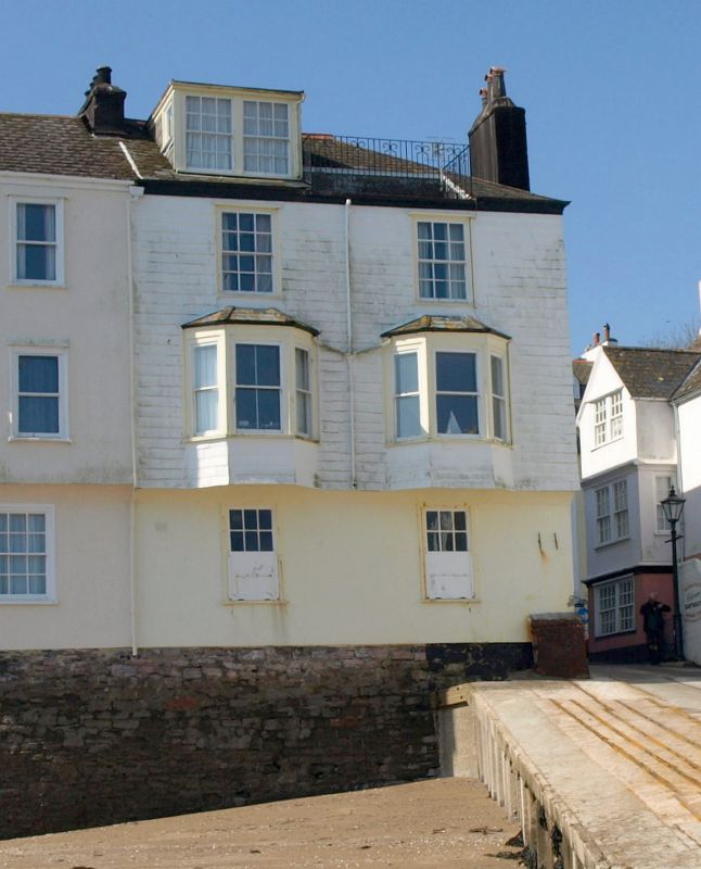
House. Mid/late C19, possibly earlier core. Plastered stone rubble and timber-framing, painted slate-hung timber-framing on the east side; front and back end stacks with plastered brick chimneyshafts and pots; slate roof. PLAN: Entrance front is one room wide and 2 rooms deep. EXTERIOR: 3 storeys and attic; one-window range. Plaster front is lightly blocked out as ashlar. Square-headed doorway to right side. 4-panel door under overlight with a geometric pattern of glazing bars recessed with panelled reveals up 3 stone steps. Apart from the doorway there is only a tiny horned 8-pane sash window, second-floor right, on this side. Plain eaves. Roof continuous with those of neighbouring houses with hipped corner. Long riverside front jettied out at first-floor level, and is slate-hung above. Regular 2-window front. Ground floor has 12-pane sashes, the lower sashes replaced (or protected) by boarded shutters. First-floor canted bays with hipped roofs containing late C19 sashes without glazing bars. 12-pane sashes to the second floor and flat-roofed dormer containing a pair of 12-pane sashes. INTERIOR: not inspected but likely to be of interest. Built on an artificial platform projecting into the river alongside the ferry slip. This house forms part of a group of listed riverside buildings on Ferry Slip, Sunderland Terrace and Lower Street which also line the approach to Bayards Cove. Included for group value.
Listing NGR: SX8785151076
External links are from the relevant listing authority and, where applicable, Wikidata. Wikidata IDs may be related buildings as well as this specific building. If you want to add or update a link, you will need to do so by editing the Wikidata entry.


Other nearby listed buildings