Latitude: 50.3489 / 50°20'55"N
Longitude: -3.5776 / 3°34'39"W
OS Eastings: 287850
OS Northings: 51072
OS Grid: SX878510
Mapcode National: GBR QS.RJGY
Mapcode Global: FRA 38D3.VCQ
Plus Code: 9C2R8CXC+GW
Entry Name: 25 and 25A, Lower Street
Listing Date: 14 September 1949
Last Amended: 23 February 1994
Grade: II
Source: Historic England
Source ID: 1292522
English Heritage Legacy ID: 387281
ID on this website: 101292522
Location: Kingswear, South Hams, Devon, TQ6
County: Devon
District: South Hams
Civil Parish: Dartmouth
Built-Up Area: Dartmouth
Traditional County: Devon
Lieutenancy Area (Ceremonial County): Devon
Church of England Parish: Dartmouth Townstal
Church of England Diocese: Exeter
Tagged with: Building
DARTMOUTH
SX874510 LOWER STREET 673-1/8/160 (East side) 14/09/49 Nos.25 AND 25A Island House (Formerly Listed as: LOWER STREET (East side) Nos.21-24 (Consecutive) and No.25 Island House)
GV II
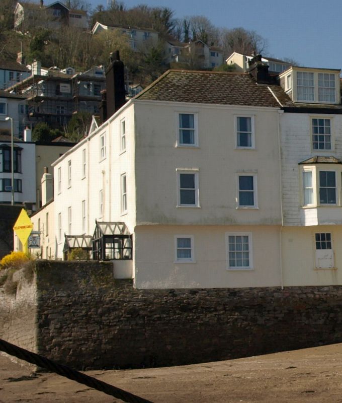
Two houses, now divided into flats. Probably mid C19 with earlier origins. Plastered walls, partly stone rubble, partly timber-framing; rear and left end stack and front lateral stacks with painted brick chimneyshafts; slate roof. PLAN: Entrance front facing south towards Bayards Cove has a 3-room plan with main entrance left of centre to the stairs. Right (east) return has 2-room wing. EXTERIOR: 3 storeys; irregular 3-window front of horned 4-pane sashes. Doorway left of centre contains a part-glazed 6-panel door behind a C20 glazed porch, and doorway at the right end contains a C20 part-glazed door behind another glazed porch. The right (east) return is jettied at first-floor level over the river. It has a 2-window front including a 12-pane sash at ground-floor level and horned 4-pane sashes to the upper floors. Roof is continuous with those of the adjoining properties and is hipped on the corner. INTERIOR: Not inspected but likely to be of interest. One of a good group of listed buildings on the Ferry Slip, at the southern end of Lower Street and at the northern end of Bayards Cove. Included for group value.
Listing NGR: SX8785051072
External links are from the relevant listing authority and, where applicable, Wikidata. Wikidata IDs may be related buildings as well as this specific building. If you want to add or update a link, you will need to do so by editing the Wikidata entry.


Other nearby listed buildings