Latitude: 51.1065 / 51°6'23"N
Longitude: -2.3185 / 2°19'6"W
OS Eastings: 377798
OS Northings: 134185
OS Grid: ST777341
Mapcode National: GBR 0TV.GNP
Mapcode Global: VH97Z.RGN2
Plus Code: 9C3V4M4J+JJ
Entry Name: South Range of Workshops on South Side of Stable Yard
Listing Date: 9 September 1987
Grade: II
Source: Historic England
Source ID: 1199329
English Heritage Legacy ID: 321267
ID on this website: 101199329
Location: Stourton, Wiltshire, BA12
County: Wiltshire
Civil Parish: Stourton with Gasper
Traditional County: Wiltshire
Lieutenancy Area (Ceremonial County): Wiltshire
Church of England Parish: Upper Stour
Church of England Diocese: Salisbury
Tagged with: Architectural structure
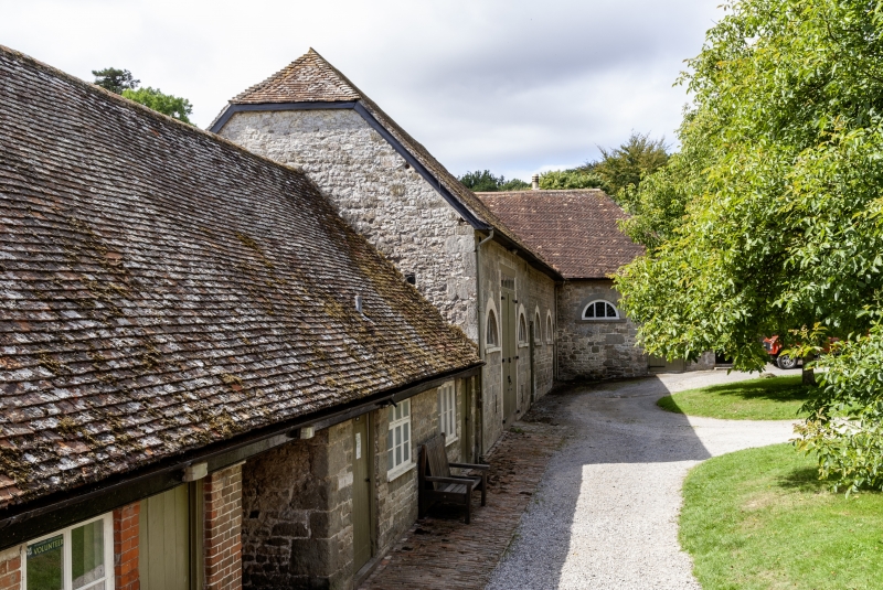
STOURTON WITH GASPER STOURHEAD PARK ST 73 SE (south side) 6/161 South range of workshops on south side of Stable Yard GV II Barn, stables and tackroom, now workshops and accommodation. Late C18, remodelled early 1900s. Rubble stone and dressed limestone, tiled roofs with bands of fishscale tiles. Former barn to west end of range has double doors and lunette to left, 3 lunettes to right, short wing projecting to right has planked stable door and lunette. Lower range to left with planked doors and casements and throughway to yard beyond. South side of barn is brick and windowless, workshops to right have lunettes and oculus, Tudor- arched doorway to passage, 2 gabled attic dormers. Interiors have early C20 roofs, evidence of earlier phases of use in truncated stacks and various blocked or inserted openings. This range, together with other buildings in the stable yard, was probably part of a C18 farm group - subsequently converted to stabling and carriage houses for Stourhead House.
Listing NGR: ST7779834185
External links are from the relevant listing authority and, where applicable, Wikidata. Wikidata IDs may be related buildings as well as this specific building. If you want to add or update a link, you will need to do so by editing the Wikidata entry.


Other nearby listed buildings