Latitude: 51.7396 / 51°44'22"N
Longitude: -1.6533 / 1°39'11"W
OS Eastings: 424034
OS Northings: 204605
OS Grid: SP240046
Mapcode National: GBR 5TM.W9N
Mapcode Global: VHC05.9J9R
Plus Code: 9C3WP8QW+VM
Entry Name: Peartree Farmhouse
Listing Date: 12 September 1955
Grade: II
Source: Historic England
Source ID: 1199936
English Heritage Legacy ID: 253524
ID on this website: 101199936
Location: Filkins, West Oxfordshire, GL7
County: Oxfordshire
District: West Oxfordshire
Civil Parish: Filkins and Broughton Poggs
Built-Up Area: Filkins
Traditional County: Oxfordshire
Lieutenancy Area (Ceremonial County): Oxfordshire
Church of England Parish: Broughton Poggs with Filkins
Church of England Diocese: Oxford
Tagged with: Farmhouse
SP2404-2504 FILKINS AND BROUGHTON POGGS VILLAGE STREET (North-west side) Filkins 8/202 Peartree Farmhouse 112/09/55
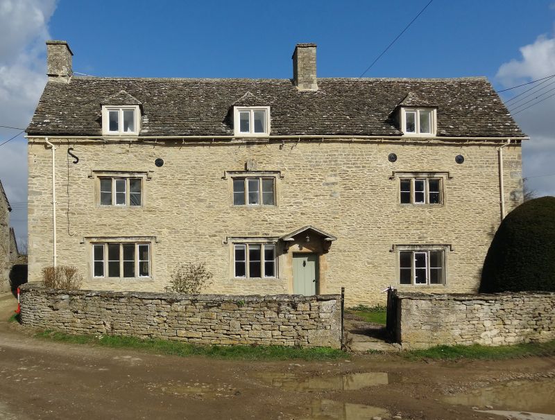
GV II Farmhouse. Possibly mid C17 in origin, raised and dated JPA 1683 on tablet below central dormer. Late C18-C19 wing to rear. Coursed rubble limestone with dressed quoins and stone slate roof. Rubble stone chimneys to left and between right bays. 2 storeys and attic, 3 bays. Stone mullion windows with recessed chamfers, Tudor hood moulds, and single horizontal metal glazing bars. Most windows to ground and first floors have 3 lights, but ground floor left bay has 4-light window. Attic has similar 2-light casements without hoodmoulds in hipped eaves-line dormers. Old board door to right of centre window has chamfered stone surround with open pediment hood of moulded stone on shaped stone scroll brackets. Above central first floor window is a square stone tablet with sundial. Raised walling has round ends of metal tie-bars.
Listing NGR: SP2403404605
External links are from the relevant listing authority and, where applicable, Wikidata. Wikidata IDs may be related buildings as well as this specific building. If you want to add or update a link, you will need to do so by editing the Wikidata entry.


Other nearby listed buildings