Approximate Location Map
Large Map »
Latitude: 53.9042 / 53°54'15"N
Longitude: -1.6932 / 1°41'35"W
OS Eastings: 420256
OS Northings: 445384
OS Grid: SE202453
Mapcode National: GBR JRM9.75
Mapcode Global: WHC8X.Y4W8
Plus Code: 9C5WW834+MP
Entry Name: 16, Bondgate
Listing Date: 8 July 1974
Grade: II
Source: Historic England
Source ID: 1200045
English Heritage Legacy ID: 341368
ID on this website: 101200045
Location: Otley, Leeds, West Yorkshire, LS21
County: Leeds
Civil Parish: Otley
Built-Up Area: Otley
Traditional County: Yorkshire
Lieutenancy Area (Ceremonial County): West Yorkshire
Church of England Parish: Otley All Saints
Church of England Diocese: Leeds
Tagged with: Building
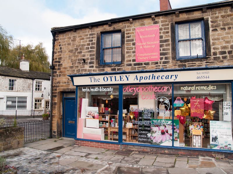
Bondgate
1.
1480
(North Side)
No 16
SE 2045 1/112
II GV
2.
Late C18 or early C19. 2 storeys in stone with stone slate roof, hipped
to right. 2 windows in stone architraves. Similar architrave to door.
Late C19 shop front. Same build as part of No 29 New Market (Ring of
Bells Public House).
Nos 10 to 34 (even) and 38 to 44 (even) form a group.
Listing NGR: SE2025645385
External links are from the relevant listing authority and, where applicable, Wikidata. Wikidata IDs may be related buildings as well as this specific building. If you want to add or update a link, you will need to do so by editing the Wikidata entry.


Other nearby listed buildings
