Latitude: 53.9043 / 53°54'15"N
Longitude: -1.6939 / 1°41'37"W
OS Eastings: 420209
OS Northings: 445396
OS Grid: SE202453
Mapcode National: GBR JRM9.24
Mapcode Global: WHC8X.Y4K6
Plus Code: 9C5WW834+PC
Entry Name: 50-54, Kirkgate
Listing Date: 8 July 1974
Grade: II
Source: Historic England
Source ID: 1200349
English Heritage Legacy ID: 341457
ID on this website: 101200349
Location: Otley, Leeds, West Yorkshire, LS21
County: Leeds
Civil Parish: Otley
Built-Up Area: Otley
Traditional County: Yorkshire
Lieutenancy Area (Ceremonial County): West Yorkshire
Church of England Parish: Otley All Saints
Church of England Diocese: Leeds
Tagged with: Building
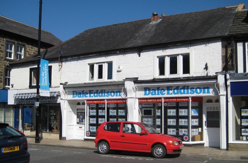
Kirkgate
1.
1480
(East Side)
Nos 50 to 54 (even)
SE 20454 1/200
II GV
2.
C18. Two storeys in stone with Welsh slate roof, hipped to corner. Three
three-light mullion windows in stone architraves. Ground floor has two
late C19 three-light shop front windows and modern door. Painted.
Nos 44 to 58 (even) form a group.
Listing NGR: SE2021245393
External links are from the relevant listing authority and, where applicable, Wikidata. Wikidata IDs may be related buildings as well as this specific building. If you want to add or update a link, you will need to do so by editing the Wikidata entry.


Other nearby listed buildings