Latitude: 54.5456 / 54°32'44"N
Longitude: -1.9237 / 1°55'25"W
OS Eastings: 405033
OS Northings: 516704
OS Grid: NZ050167
Mapcode National: GBR HH0W.B9
Mapcode Global: WHB4L.F05M
Plus Code: 9C6WG3WG+6G
Entry Name: 34, Galgate
Listing Date: 22 February 1973
Last Amended: 28 November 1994
Grade: II
Source: Historic England
Source ID: 1201065
English Heritage Legacy ID: 388664
ID on this website: 101201065
Location: Barnard Castle, County Durham, DL12
County: County Durham
Civil Parish: Barnard Castle
Built-Up Area: Barnard Castle
Traditional County: Durham
Lieutenancy Area (Ceremonial County): County Durham
Church of England Parish: Barnard Castle with Whorlton
Church of England Diocese: Durham
Tagged with: Building
BARNARD CASTLE
NZ0516NW GALGATE 770-1/4/35 (North West side) 22/02/73 No.34 (Formerly Listed as: BANRARD CASTLE GALGATE (North side) Nos.34 AND 36)
GV II
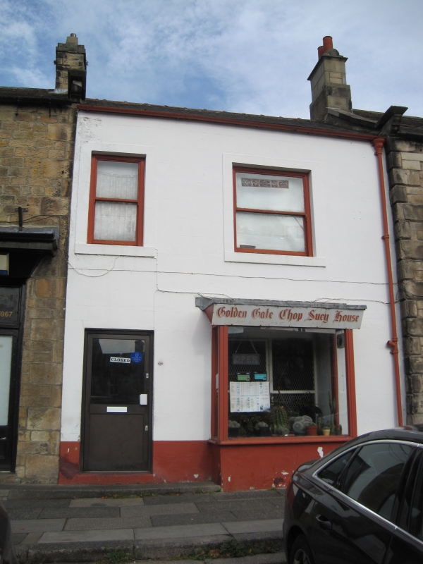
House, now shop and flat. Late C18, altered C20. Render with painted ashlar dressings; Welsh slate roof with red ridge tiles. 2 storeys; 2-window range. Half-glazed door at left in plain reveals; late C20 shop window at right under small fascia possibly covering C19 fascia. Plain stone surrounds to renewed plain first-floor sashes, the right wider. Roof shows no detail; possibly chimney is one of those on adjacent property. INTERIOR: not inspected.
Listing NGR: NZ0502816709
External links are from the relevant listing authority and, where applicable, Wikidata. Wikidata IDs may be related buildings as well as this specific building. If you want to add or update a link, you will need to do so by editing the Wikidata entry.


Other nearby listed buildings