Latitude: 51.232 / 51°13'55"N
Longitude: -3.8307 / 3°49'50"W
OS Eastings: 272276
OS Northings: 149683
OS Grid: SS722496
Mapcode National: GBR L1.2PCC
Mapcode Global: VH4M9.K96D
Plus Code: 9C3R65J9+RP
Entry Name: The Pier
Listing Date: 19 July 1950
Last Amended: 9 June 1995
Grade: II
Source: Historic England
Source ID: 1201156
English Heritage Legacy ID: 376544
ID on this website: 101201156
Location: Lynmouth, North Devon, EX35
County: Devon
District: North Devon
Civil Parish: Lynton and Lynmouth
Built-Up Area: Lynton
Traditional County: Devon
Lieutenancy Area (Ceremonial County): Devon
Church of England Parish: Countisbury with Lynmouth St John the Evangelist
Church of England Diocese: Exeter
Tagged with: Architectural structure
LYNTON AND LYNMOUTH
SS7149 THE ESPLANADE, Lynmouth 858-1/4/88 (North side) 19/07/50 The Pier (Formerly Listed as: LYNTON THE ESPLANADE The Quay)
GV II
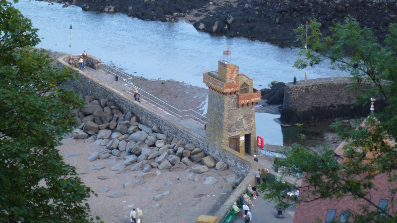
Pier, part of general quay construction. Late C18 or early C19, badly damaged by floods 1952, rebuilt 1954. Rubble and dressed granite, asphalt paving. A short length of vertical quay wall, projecting NE from the junction of The Esplanade with Lynmouth Street. The wall on the outer, NW side is in roughly squared granite blocks, brought to a weathered and rounded flush granite parapet approx 1.5m high, returning across the end, and containing the path, which passes under the Rhenish Tower (qv), and has tubular railings to the SE side. From a broader platform raised on 2 steps at the street end is a long ramp, and beyond the Tower a flight of 20 steps set into the wall.
Listing NGR: SS7227649683
External links are from the relevant listing authority and, where applicable, Wikidata. Wikidata IDs may be related buildings as well as this specific building. If you want to add or update a link, you will need to do so by editing the Wikidata entry.


Other nearby listed buildings