Latitude: 51.9904 / 51°59'25"N
Longitude: -2.1614 / 2°9'40"W
OS Eastings: 389016
OS Northings: 232454
OS Grid: SO890324
Mapcode National: GBR 1JR.0F1
Mapcode Global: VH93T.H77G
Plus Code: 9C3VXRRQ+5F
Entry Name: Unidentified Monument Approximately 4 Metres West of Path and 25 Metres North of Abbey North Porch
Listing Date: 25 April 1994
Grade: II
Source: Historic England
Source ID: 1201174
English Heritage Legacy ID: 376587
ID on this website: 101201174
Location: St Mary's Abbey Church, Tewkesbury, Gloucestershire, GL20
County: Gloucestershire
District: Tewkesbury
Civil Parish: Tewkesbury
Built-Up Area: Tewkesbury
Traditional County: Gloucestershire
Lieutenancy Area (Ceremonial County): Gloucestershire
Church of England Parish: Tewkesbury St Mary the Virgin (Tewkesbury Abbey)
Church of England Diocese: Gloucester
Tagged with: Monument
TEWKESBURY
SO8932 ABBEY CHURCHYARD, Abbey Precincts 859-1/6/355 Unidentified monument approx. 4m W of path and 25m N of Abbey north porch
GV II
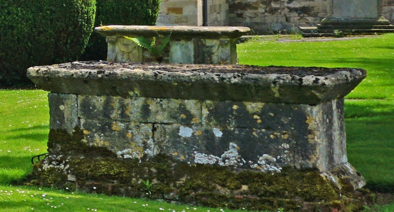
Chest tomb, C17. Limestone. Very thick ledger slab to deep chamfered edges on plain slab sides to splayed base on brick sub-structure. No inscriptions or decoration; traditionally the ledger is said to be the Norman high altar, the top surface is badly pitted but there is no evidence for consecration crosses. The overall heavy form is charac- teristic of the C17.
Listing NGR: SO8901632454
External links are from the relevant listing authority and, where applicable, Wikidata. Wikidata IDs may be related buildings as well as this specific building. If you want to add or update a link, you will need to do so by editing the Wikidata entry.


Other nearby listed buildings