Latitude: 51.9912 / 51°59'28"N
Longitude: -2.1624 / 2°9'44"W
OS Eastings: 388942
OS Northings: 232543
OS Grid: SO889325
Mapcode National: GBR 1JR.03Z
Mapcode Global: VH93T.G6NV
Plus Code: 9C3VXRRQ+F2
Entry Name: Raised Pavement to Front of Numbers 12 to 15
Listing Date: 25 April 1994
Grade: II
Source: Historic England
Source ID: 1201284
English Heritage Legacy ID: 376884
ID on this website: 101201284
Location: Tewkesbury, Gloucestershire, GL20
County: Gloucestershire
District: Tewkesbury
Civil Parish: Tewkesbury
Built-Up Area: Tewkesbury
Traditional County: Gloucestershire
Lieutenancy Area (Ceremonial County): Gloucestershire
Church of England Parish: Tewkesbury St Mary the Virgin (Tewkesbury Abbey)
Church of England Diocese: Gloucester
Tagged with: Architectural structure
TEWKESBURY
SO83SE MILL STREET 859-1/2/303 (North East side) Raised pavement to front of Nos.12-15
GV II
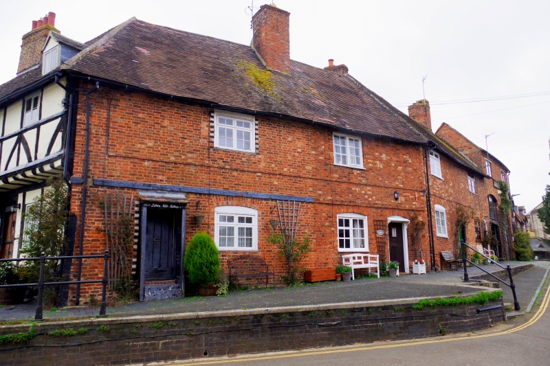
Raised pavement with steps. C19, but possibly replacing earlier version. Brick paving full width of frontages, retained by blue brick wall to brick-on-edge coping, rising to maximum 8 courses, but dying to road level at right end. Paved area, partly in asphalt, much wider opposite Nos 14 and 15 (qv), with return length of walling containing flight of 4 stone steps, beyond which retaining wall curves back in segment to wall opposite Nos 12 & 13 (qv). Part of raised pavement continued to St Mary's Road. The houses set at higher level than road here to raise them above the normal flood level; the water rarely rises above this level.
Listing NGR: SO8894232543
External links are from the relevant listing authority and, where applicable, Wikidata. Wikidata IDs may be related buildings as well as this specific building. If you want to add or update a link, you will need to do so by editing the Wikidata entry.


Other nearby listed buildings