Latitude: 54.5407 / 54°32'26"N
Longitude: -1.9166 / 1°54'59"W
OS Eastings: 405491
OS Northings: 516161
OS Grid: NZ054161
Mapcode National: GBR HH1Y.V2
Mapcode Global: WHB4L.J4JC
Plus Code: 9C6WG3RM+78
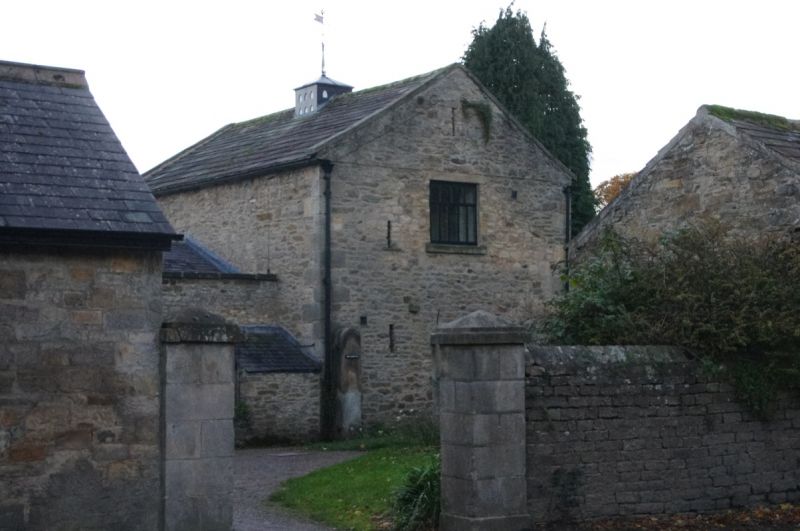
Entry Name: Hayloft and Dovecote Approximately 40 Metres East of Spring Lodge with Sheds, Kennels and Wall
Listing Date: 28 November 1994
Grade: II
Source: Historic England
Source ID: 1201302
English Heritage Legacy ID: 388797
ID on this website: 101201302
Location: Lendings, County Durham, DL12
County: County Durham
Civil Parish: Barnard Castle
Built-Up Area: Barnard Castle
Traditional County: Durham
Lieutenancy Area (Ceremonial County): County Durham
Church of England Parish: Barnard Castle with Whorlton
Church of England Diocese: Durham
Tagged with: Dovecote
BARNARD CASTLE
NZ0516SW NEWGATE 770-1/6/168 (South side) Hayloft and dovecote approx. 40m E of Spring Lodge with sheds, kennels and wall
GV II
Hayloft and dovecote, with sheds and garden walls running east along drive to house, garden wall running south enclosing garden to east of house, and kennels and walls north and east of hayloft. c1827. For William Watson, and later. Coursed squared stone or snecked stone buildings with ashlar quoins and dressings; roofs of graduated stone slates with stone gable coping and timber dovecote lantern. Hayloft and dovecote one high storey; 3 bays. East elevation has alternate block jambs to full-height door for hay waggons, with vent slits in blank wall. Roof has gable copings and square ridge timber lantern pierced with triangular pigeon holes and with pyramidal roof with high weather vane finial. INTERIOR: queen post roof trusses. To west, pent sheds and outhouses with boarded doors and one fixed light with glazing bars flank walled enclosure and back against high rubble wall with flat stone coping, which curves around north side of house and returns to join yard wall (qv). To south of hayloft, a high garden wall with flat stone coping extends approx 25m southwards along garden. East of hayloft, kennels have ramped walls and iron railings against high garden wall which continues east to entrance of rear drive. A good example, in fine condition, of the auxiliary buildings of a small country house.
Listing NGR: NZ0549116161
External links are from the relevant listing authority and, where applicable, Wikidata. Wikidata IDs may be related buildings as well as this specific building. If you want to add or update a link, you will need to do so by editing the Wikidata entry.


Other nearby listed buildings