Approximate Location Map
Large Map »
Latitude: 54.5407 / 54°32'26"N
Longitude: -1.9181 / 1°55'5"W
OS Eastings: 405395
OS Northings: 516165
OS Grid: NZ053161
Mapcode National: GBR HH1Y.J1
Mapcode Global: WHB4L.H4VB
Plus Code: 9C6WG3RJ+7Q
Entry Name: Walls Around Spring Lodge Garden
Listing Date: 22 February 1973
Last Amended: 28 November 1994
Grade: II
Source: Historic England
Source ID: 1291906
English Heritage Legacy ID: 388796
ID on this website: 101291906
Location: Lendings, County Durham, DL12
County: County Durham
Civil Parish: Barnard Castle
Built-Up Area: Barnard Castle
Traditional County: Durham
Lieutenancy Area (Ceremonial County): County Durham
Church of England Parish: Barnard Castle with Whorlton
Church of England Diocese: Durham
Tagged with: Wall
BARNARD CASTLE
NZ0516SW NEWGATE
770-1/6/167 (South side)
22/02/73 Walls around Spring Lodge garden
(Formerly Listed as:
NEWGATE
(South side)
Wall between Spring Lodge garden and
Newgate)
GV II
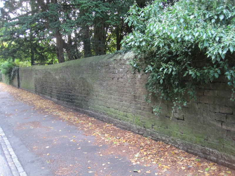
Wall and gates along north, west and south side of garden of
Spring Lodge (qv). c1820. Coursed roughly squared stone,
coursed rubble, coursed squared stone with stone coping, with
ashlar entrance piers and wrought-iron gates. Quadrant walls
flanking entrance are coursed squared stone and have flat
stone coping and square outer piers with plinths and flat
stone coping. Ashlar gate piers have panelled shafts and low
pyramidal coping, and hold vehicle gates of simple
spike-headed wrought-iron with curved lower bracing and spike
dogbars. Wall extending along Newgate to Spring Lodge Cottage
(qv) is of rougher stone with gabled coping, and ends in
vehicle entrance to west of Spring Lodge Cottage, with square
piers with pyramidal coping.
South of the entrance the wall runs along Parson's Lonnen and
returns along the Demesnes enclosing the garden; approx 1.5m
high, of rubble with gabled coping; south section has boarded
door giving access to the Demesnes.
These walls are important as streetscape and landscape
features. They are the setting for Spring Lodge, and form the
approach to the Bowes Museum, running parallel to the garden
wall of the Museum (qv), and with the wall to the Vicarage
(qv) flanking the lane to the River Tees and looking out over
the Demesnes beside the river.
Listing NGR: NZ0539516165
External links are from the relevant listing authority and, where applicable, Wikidata. Wikidata IDs may be related buildings as well as this specific building. If you want to add or update a link, you will need to do so by editing the Wikidata entry.


Other nearby listed buildings
