Latitude: 54.5471 / 54°32'49"N
Longitude: -1.9196 / 1°55'10"W
OS Eastings: 405295
OS Northings: 516875
OS Grid: NZ052168
Mapcode National: GBR HH1V.6R
Mapcode Global: WHB4D.HZ30
Plus Code: 9C6WG3WJ+R4
Entry Name: 112, Galgate
Listing Date: 22 February 1973
Last Amended: 28 November 1994
Grade: II
Source: Historic England
Source ID: 1201342
English Heritage Legacy ID: 388694
ID on this website: 101201342
Location: Barnard Castle, County Durham, DL12
County: County Durham
Civil Parish: Barnard Castle
Built-Up Area: Barnard Castle
Traditional County: Durham
Lieutenancy Area (Ceremonial County): County Durham
Church of England Parish: Barnard Castle with Whorlton
Church of England Diocese: Durham
Tagged with: Building
BARNARD CASTLE
NZ0516NW GALGATE 770-1/4/65 (North West side) 22/02/73 No.112 (Formerly Listed as: GALGATE (North side) Nos.100-116 (Even))
GV II
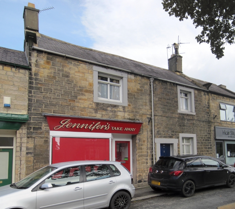
House, now shop, flat and house. Late C18 with C20 alterations. Coursed squared stone with rendered plinth and ashlar dressings; Welsh slate roof with stone gable coping and rendered chimneys. 2 storeys; 2-window range. Left bay wider. Shop front at left has wide window and glazed door at right under renewed fascia. 4-panel door in low plain stone surround to right of centre. Long window to right of door, and smaller first-floor windows, the left square, have C20 cross-casements and plain stone surrounds. Roof has gable coping on moulded kneelers, and end chimneys. INTERIOR: not inspected. Included for group value.
Listing NGR: NZ0529516875
External links are from the relevant listing authority and, where applicable, Wikidata. Wikidata IDs may be related buildings as well as this specific building. If you want to add or update a link, you will need to do so by editing the Wikidata entry.


Other nearby listed buildings