Latitude: 53.3878 / 53°23'16"N
Longitude: -3.0438 / 3°2'37"W
OS Eastings: 330676
OS Northings: 388391
OS Grid: SJ306883
Mapcode National: GBR 7Y58.T9
Mapcode Global: WH87D.63VP
Plus Code: 9C5R9XQ4+4F
Entry Name: 32 34, Devonshire Road
Listing Date: 28 March 1974
Grade: II
Source: Historic England
Source ID: 1201572
English Heritage Legacy ID: 389180
ID on this website: 101201572
Location: Claughton, Wirral, Merseyside, CH43
County: Wirral
Electoral Ward/Division: Oxton
Parish: Non Civil Parish
Built-Up Area: Birkenhead
Traditional County: Cheshire
Lieutenancy Area (Ceremonial County): Merseyside
Church of England Parish: Birkenhead Christ Church
Church of England Diocese: Chester
Tagged with: Building
BIRKENHEAD
SJ3088 DEVONSHIRE ROAD, Claughton 789-1/10/192 (North side) 28/03/74 Nos.32 AND 34
GV II
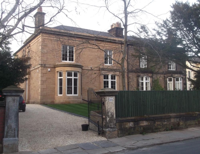
Pair of houses. c1850. By Charles Reed. Ashlar-faced with hipped Welsh slate roof. 2 storeys, each a 2-room double-depth plan with side entrance. Outer bow window with mullioned and transomed window to ground floor, 2-light windows above and on each floor in inner bay. Angle quoins and sill bands, moulded cornice and parapet. Door in stressed architrave in side elevation. End wall stacks. The houses form part of the original development at Claughton, laid out by Reed for Sir William Jackson from the early 1840's. (Map of Claughton in 1848; Plan of Birkenhead and Claughton cum Grange 1858: Mills and Fletcher, Surveyors: 1858-).
Listing NGR: SJ3067688391
External links are from the relevant listing authority and, where applicable, Wikidata. Wikidata IDs may be related buildings as well as this specific building. If you want to add or update a link, you will need to do so by editing the Wikidata entry.


Other nearby listed buildings