Latitude: 52.5814 / 52°34'52"N
Longitude: -2.1304 / 2°7'49"W
OS Eastings: 391260
OS Northings: 298182
OS Grid: SO912981
Mapcode National: GBR 1CM.S1
Mapcode Global: WHBFZ.7CSW
Plus Code: 9C4VHVJ9+HR
Entry Name: 2 and 3, Church Street
Listing Date: 3 February 1977
Grade: II
Source: Historic England
Source ID: 1201796
English Heritage Legacy ID: 378364
ID on this website: 101201796
Location: Wolverhampton, West Midlands, WV2
County: City of Wolverhampton
Electoral Ward/Division: St Peter's
Parish: Non Civil Parish
Built-Up Area: Wolverhampton
Traditional County: Staffordshire
Lieutenancy Area (Ceremonial County): West Midlands
Church of England Parish: Central Wolverhampton
Church of England Diocese: Lichfield
Tagged with: Building
WOLVERHAMPTON
SO9198SW CHURCH STREET 895-1/13/209 (North side) 03/02/77 Nos.2 AND 3
II
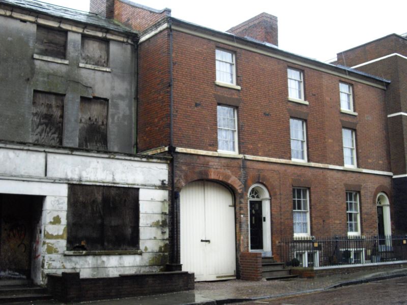
2 houses, now offices. Late C18. Brick with stone dressings, slate roof. Double-depth plan. 3 storeys with basement; 3-window range. 1st floor sill band and top cornice, returned to left hand end. Basement has window with paired 8-pane sashes in chamfered reveals and a window with tripartite sash; ground and 1st floor windows have rubbed brick flat arches, two 12-pane sashes and 4-pane horned sash; 2nd floor has 2 altered 9-pane sashes and 4-pane horned sash. Left end has elliptical-arched carriage entry; round-headed entrance to right with reeded pilasters and archivolt, fanlight with radiating glazing bars and glazed door; similar entrance to left end. Round-headed entrance to left side, set in aedicule with Doric columns with fluted capitals, entablature blocks with oval paterae and fluted sides, open pediment and patera over fanlight with decorative glazing bars and 6-fielded-panel door. Coped gable with projecting stack, and cross-axial stack. Spear-headed area railings. INTERIOR not inspected. Built as part of the St.John's Square development.
Listing NGR: SO9126098182
External links are from the relevant listing authority and, where applicable, Wikidata. Wikidata IDs may be related buildings as well as this specific building. If you want to add or update a link, you will need to do so by editing the Wikidata entry.


Other nearby listed buildings