Latitude: 51.4723 / 51°28'20"N
Longitude: -2.6284 / 2°37'42"W
OS Eastings: 356449
OS Northings: 175005
OS Grid: ST564750
Mapcode National: GBR C0C.L1
Mapcode Global: VH88M.D8B4
Plus Code: 9C3VF9CC+WJ
Entry Name: 4 and 5, Rockleaze
Listing Date: 4 March 1977
Grade: II
Source: Historic England
Source ID: 1202510
English Heritage Legacy ID: 380377
ID on this website: 101202510
Location: Sneyd Park, Bristol, BS9
County: City of Bristol
Electoral Ward/Division: Stoke Bishop
Parish: Non Civil Parish
Built-Up Area: Bristol
Traditional County: Gloucestershire
Lieutenancy Area (Ceremonial County): Bristol
Church of England Parish: Stoke Bishop
Church of England Diocese: Bristol
Tagged with: Building
BRISTOL
ST5675 ROCKLEAZE, Sneyd Park 901-1/31/1814 (North West side) 04/03/77 Nos.4 AND 5
GV II
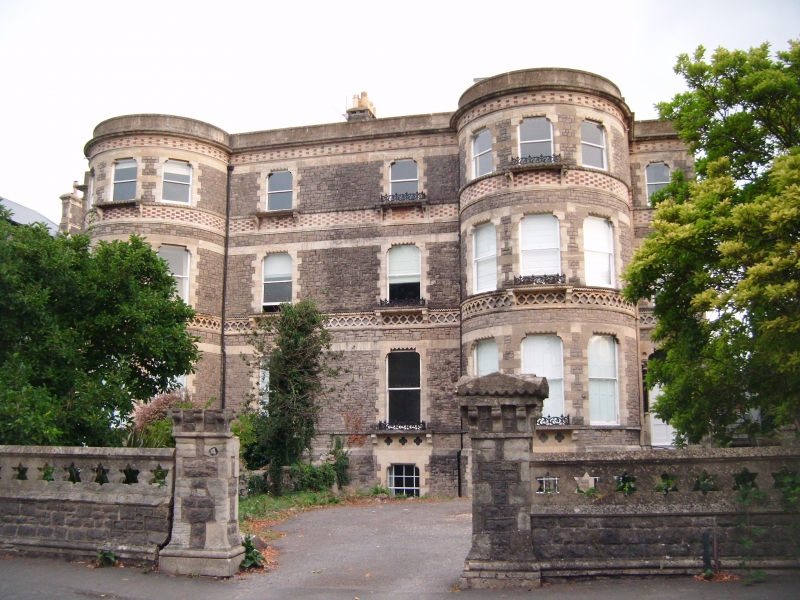
Pair of attached houses. c1860. Snecked Pennant rubble with limestone dressings and brick details, stone gable and ridge stacks, and tile gable and hipped roof. Double-depth plan. Classical style. 3 storeys; 10-window range. Full height semicircular bows with band of stone bricks and headers below the pierced parapet, a band of terracotta panels below the second-floor windows and entrances in the side elevations, that to No.5 with rock-faced column and tiled roof. Flat-headed windows, arched in the centre, to plate-glass sashes, 3 windows to the bows, 1 either side and 2 between; doorways in the end blocks; pierced parapet along the full width. INTERIOR not inspected.
Listing NGR: ST5644975005
External links are from the relevant listing authority and, where applicable, Wikidata. Wikidata IDs may be related buildings as well as this specific building. If you want to add or update a link, you will need to do so by editing the Wikidata entry.


Other nearby listed buildings