Latitude: 51.4537 / 51°27'13"N
Longitude: -2.6213 / 2°37'16"W
OS Eastings: 356927
OS Northings: 172928
OS Grid: ST569729
Mapcode National: GBR C2K.6R
Mapcode Global: VH88M.JQ3G
Plus Code: 9C3VF93H+FF
Entry Name: Raised Pavement, Railings and Vaults Fronting Numbers 1 to 52 for Approximately 330 Metres
Listing Date: 8 January 1959
Last Amended: 30 December 1994
Grade: II*
Source: Historic England
Source ID: 1202516
English Heritage Legacy ID: 380394
ID on this website: 101202516
Location: Hotwells, Bristol, BS8
County: City of Bristol
Electoral Ward/Division: Clifton
Parish: Non Civil Parish
Built-Up Area: Bristol
Traditional County: Gloucestershire
Lieutenancy Area (Ceremonial County): Bristol
Church of England Parish: Clifton Christ Church with Emmanuel
Church of England Diocese: Bristol
Tagged with: Architectural structure
BRISTOL
ST5672NE ROYAL YORK CRESCENT, Clifton 901-1/13/1012 (North West side) 08/01/59 Raised pavement, railings and vaults fronting Nos.1-52 for approx 330 metres (Formerly Listed as: ROYAL YORK CRESCENT, Clifton (North West side) Nos.1-12, 12A AND 14-46)
GV II*
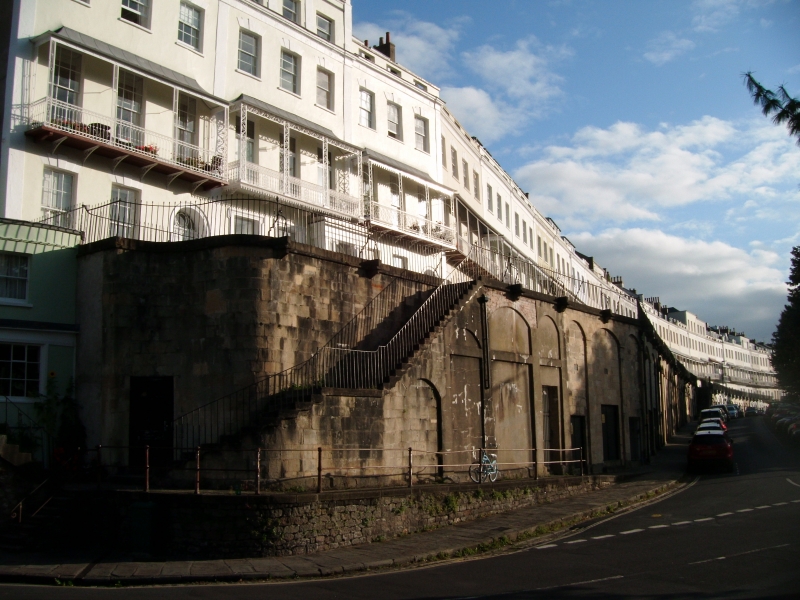
Raised pavement and vaulted cellars. Late C18/early C19. Limestone ashlar and Pennant flags. The pavement extends up to 10m in front of the crescent, with steps down through basement areas; each house has 3 segmental-arched vaults beneath. The front elevation of the pavement expresses the vaults in triple segmental-arched recesses, wider to the middle, most with later garage openings. The left-hand end curves in, with a flight of steps down, and there are 4 other sets of steps along the pavement before it comes to ground level at the right-hand end. INTERIOR: plain arched vaults. SUBSIDIARY FEATURES: attached iron railings and stanchions extend the full width of the front wall. A prominent feature of what is reputed to be the longest terrace in Europe, and forming an important part of the view of Clifton from the S. HISTORICAL NOTE: the crescent was begun 1791 by James Lockier, probably to a design of William Paty, work stopped 1793, restarted 1809 and completed 1820.
Listing NGR: ST5692772928
External links are from the relevant listing authority and, where applicable, Wikidata. Wikidata IDs may be related buildings as well as this specific building. If you want to add or update a link, you will need to do so by editing the Wikidata entry.


Other nearby listed buildings